Trees on Farms event
Planting trees on farms offers opportunities for farmers to diversify their income through revegetation, carbon benefits, increased agricultural productivity, and timber supply.
Learn how trees can benefit your farm and the opportunities for agroforestry in livestock enterprises at this free farm field day event presented by the West Gippsland CMA and Maffra and Districts Landcare Network.
Speakers:
- Sheep and wool farmer Bob Gray will share his experience establishing a hardwood agroforestry system in wet, steep country and what he’s learned after 14 years.
- Callam Reynolds from Maffra and Districts Landcare Network will explain how farmers can apply for funding under the Victorian Trees on Farms Program.
Date: Tuesday 24 February 2026
Time: 10.00am – 12.30pm
Location: 585 Torwood-Topiram Road, Torwood
Cost: Free lunch provided – please register
Contact
If you have any questions, please contact Sam Shannon on 0409 944 114.
This event is one of a series of workshops offered under our Carbon Farming Outreach Program, which provides free training for farmers across the West Gippsland catchment to better understand their emissions and learn the benefits of carbon farming.
Event partners:
The Victorian Carbon Farming Outreach Program is delivered with funding support from the Commonwealth of Australia through the Department of Climate Change, Energy, the Environment and Water under the National Carbon Farming Outreach Program. The Program is delivered through a partnership between Agriculture Victoria, 10 Catchment Management Authorities and Landcare Victoria and other bodies.
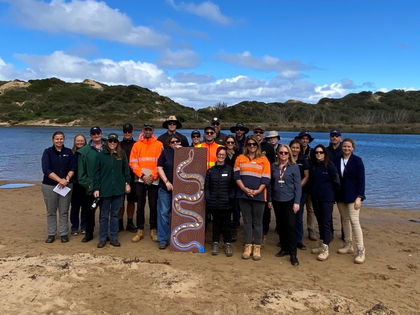
Strong Country healthy wetlands
World Wetlands Day will be celebrated in West Gippsland and around the world on Monday 2 February.
West Gippsland is home to a number of internationally and nationally significant wetlands spanning Bunurong and Gunaikurnai Country. These include the internationally important Ramsar sites of Corner Inlet and Gippsland Lakes and eleven sites listed as nationally important under the Directory of Important Wetlands Australia such as Anderson Inlet, Shallow Inlet, Kugerungomome/Powlett River mouth and Lake Wellington and Lake Victoria Wetlands.
We love that this year’s theme is ‘Wetlands and traditional knowledge: Celebrating cultural heritage’. This global campaign spotlights the timeless role of traditional knowledge in sustaining wetland ecosystems and preserving cultural identity.
On Bunurong Country, we’re learning from Traditional Owners as they lead projects to protect waterways and wetlands.
“Wetlands shelter countless species, from the smallest invertebrates to migratory birds that cross entire continents,” says Renee Sweetman, Balirt biik Aboriginal Water Officer for Bunurong Land Council Aboriginal Corporation.
“But their value extends beyond ecology. Wetlands are cultural landscapes – living places of story, identity, and knowledge. For First Peoples, wetlands are part of an unbroken relationship with Country, where land, water, people, and spirit are inseparable. These places teach us balance, reciprocity and responsibility.”
“The majority of Aboriginal people in Victoria use the Wetlands like ‘fridges’ to get all the materials you need, such as plants to make nets, ropes, tools and for medicinal use,” adds Baden Moore, the Land Council’s Strong Country, Water Team Leader.
Some mobs used Wetlands to catch fish and have a consistent source of fish throughout the year. Some wetlands were like nurseries for breeding fish so during inundation the fish can join the mainstream.”
Baden, Renee and team are working to imbed traditional knowledge into water management with:
- Bunurong Waterway Assessments: To find the cultural values that are significant to Bunurong people, and enable the Water Team to plant Medicine, Tool making and weaving plants along other waterways to imbed Bunurong cultural values into waterway management.
- Riparian and Aquatic Revegetation.
- Aquaculture: the team are planning an Aquaculture nursery, growing Aquatic plants and breeding fish.
Landscapes in Motion
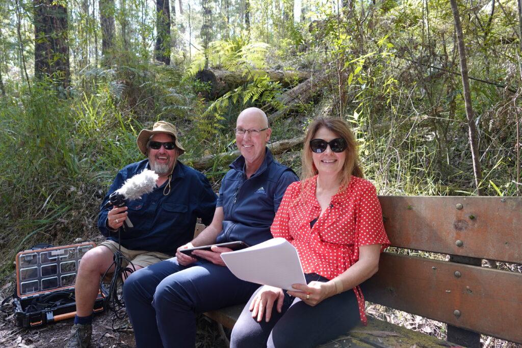
In our final episode for 2025, we chat with our CEO Marty Fuller about the year that was, the year that’s coming and why CMAs and partners are so vital to healthy landscapes.
Get to know a bit more about us and the work we do in your communities. As we walk along the picturesque Lyrebird Walk in Mirboo North on Gunaikurnai Country, Marty reflects on the landscape-scale changes he’s witnessed in his 24-years at the CMA and across 2025.
“I’m at that point where I can drive around and get a real sense of achievement seeing landscapes that are changing off the back of the work that CMAs do with communities and partners. I feel very privileged to work in such a great industry, in the best region in the world,” said Marty.
Some of these long-term projects include:
- Decades of work with farmers, foresters, fishers and community to protect Corner Inlet.
- More recently, the catchment-scale impact of the Kugerungmome/Powlett River Partnerships project.
- Collective efforts around the Gippsland Lakes.
- Initiatives in and around the Latrobe system.
- A quarter of a century of working with irrigators in the Macalister Irrigation District to save water and reduce nutrient run-off.
- Celebrating 20-years of environmental water in the Carran Carran (Thomson River).
Looking ahead, some of the exciting projects on the calendar for 2026 are:
- New infrastructure to help environmental water at Heart Morass.
- A new fishway at Maffra to support migratory fish on their journey.
- Celebrating 40-years of Landcare in Victoria.
“The CMA is all about working together, caring for Country for current and future generations,” concluded Marty.
Getting down to earth about carbon farming in South Gippsland
Carbon farming is talked about a lot right now, but what exactly is it?
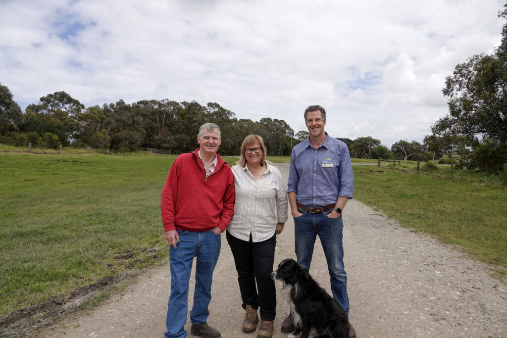
That’s what 35 South Gippsland farmers came to find out at the ‘Down to Earth Farm Field’ day at Malabar Farm in Tarwin Lower recently. The day was one of a series of workshops on the topic organised by West Gippsland Catchment Management Authority (the CMA) in partnership with Agriculture Victoria and Landcare.
The group was shown first hand by fellow farmers how it is possible to farm in a way that is in tune with the environment, creates healthier soils, helps reduce emissions and is financially successful.
“Carbon farming is a hot topic at the moment,” said Sam Shannon, Sustainable Agriculture Facilitator at the CMA. “There’s a lot of great information out there but sometimes having a chat with other local farmers facing similar challenges and conditions is the best way to learn. That’s what these farm field days are all about.”
Hosts Jenny and Paul O’Sullivan opened their farm gates to local beef, sheep, horticulture and hobby farmers from the region, including beef farmer Rob who has been farming for fifty-one years and is ‘keen to become carbon neutral’. Agriculture student Harper was just beginning his farming career and ‘came to learn’ while Jill from Fish Creek wanted to hear about improving soil health.
“There’s a thirst for knowledge about carbon storage and we know farmers like to learn from each other. This event is a way for us to share our philosophy of farming in tune with nature and talk about our experience of being involved in a pilot program to measure on-farm emissions,” said Jenny.
The audience heard about Jenny and Paul’s 34-year farming journey and their efforts to improve grazing management procedures, create healthier soils and reduce greenhouse gases on their 664-hectare beef and sheep property.
“Preserving and improving nature has always been our goal,’ said Paul. “And we’ve proven that you can have a financially successful business while also doing the right thing by the environment.”
Alison Kelly, Agriculture Victoria’s farm emissions specialist, then stepped through the process of calculating a farm’s greenhouse gas emissions using tools such as the Greenhouse Accounting Framework (GAF) calculator.
Alison Kelly, Agriculture Victoria’s farm emissions specialist, then stepped through the process of calculating a farm’s greenhouse gas emissions using tools such as the Greenhouse Accounting Framework (GAF) calculator.
Soil expert Peter Ronalds from Inspired Ag Solutions dug into the science of soil carbon explaining what it is, how it benefits productivity and the varying levels of carbon found in different soil types. He told the group that soil carbon tests help them to understand their carbon stocks and where to focus efforts to improve soil health.
“Every tonne of carbon stored in soil (or trees) can remove 3.67 tonnes of carbon dioxide from the atmosphere,” he said.
A farm tour brought the theory to life. The group visited conservation sites that Jenny and Paul have worked on over the years, including an area of remnant woodland where spectacular 300-year-old grass trees flourish thanks to fences that Jenny and Paul installed to keep cattle out.
“Understanding how to make the most of carbon farming depends on the type of farm, the business needs and the landscape it operates in. By showcasing local examples and providing practical advice, we can cut through the noise so farmers can get on with the job of sustainable farming,” concluded Sam.
For beef farmer Don, the reason for coming to the event was simple: “I love my bushland and want to protect it”.
The next farm field days focus on agroforestry, including how farmers can benefit from the Victorian Government’s ‘Trees on Farms’ program. Workshops are happening on Tuesday 17 February 2026 in Darriman and again on 24 February in Torwood. More information on the next Trees on Farms event is available here.
The Victorian Carbon Farming Outreach Program is delivered with funding support from the Commonwealth of Australia through the Department of Climate Change, Energy, the Environment and Water under the National Carbon Farming Outreach Program. The Program is delivered through a partnership between Agriculture Victoria, 10 Catchment Management Authorities and Landcare Victoria and other bodies.
With a focus on rivers and their catchments, the CMA works every day to improve catchment health through a range of programs and projects spanning from working towards self determination for Traditional Owners, partnering with legends like Landcare, Trust for Nature and Greening Australia and building relationships with the amazing landholders and community who are willing to work for river and catchment health.

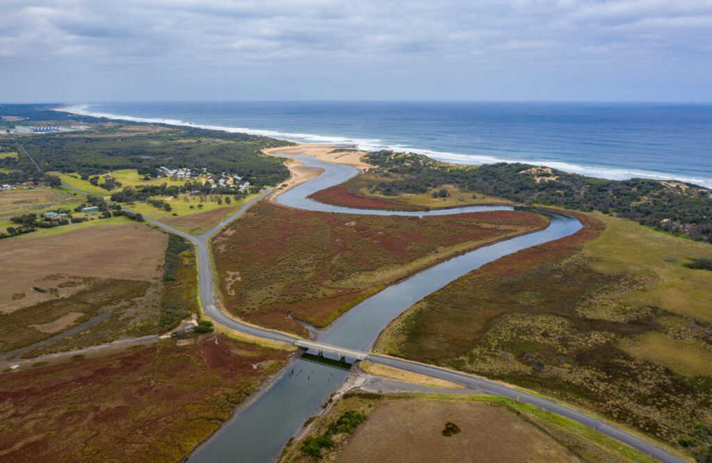
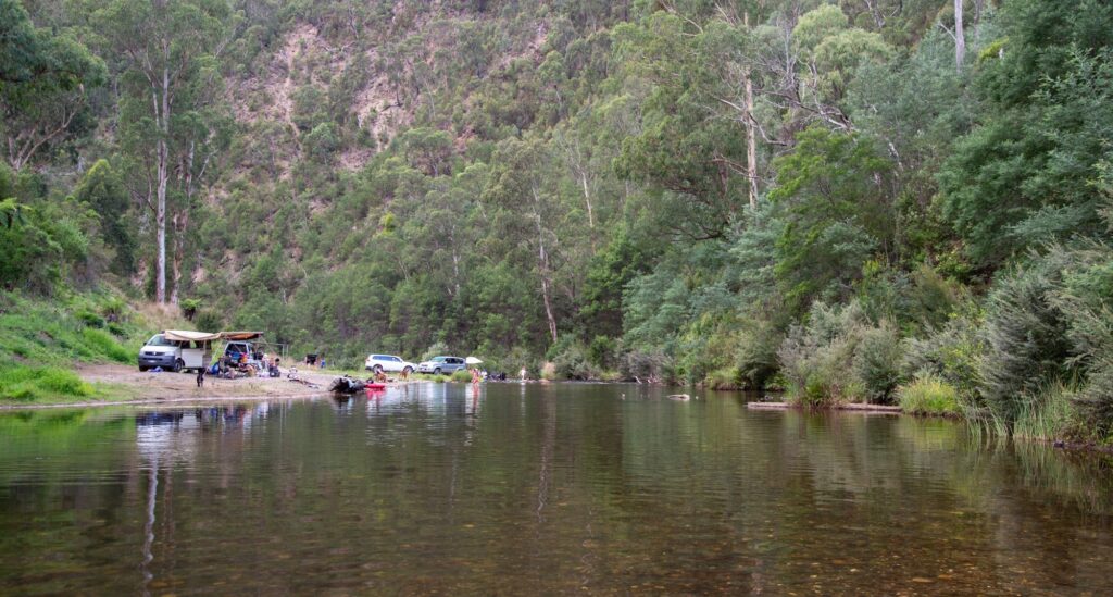
Kugerungmome/Powlett River – a river with heart
Take a trip to the picturesque Kugerungmome/Powlett River on Bunurong Country and you will see how the local community has been caring for the river and its catchment first-hand.
Kugerungmome/Powlett River enters Bass Strait at Kilcunda. It is a much-loved river alive with biodiversity, stories and cultural values. The vision for, and priority action to improve the health of the catchment have collaboratively been identified by Traditional Owners, community and partnership agencies.
A total of $1 million has been secured to support the delivery of some key projects. This second stage of the Kugerungmome project builds on the previous four-year program which established strong partnerships and collaborative delivery of on ground outcomes.
The current project will deliver environmental improvement outcomes on the ground and continue to build even stronger partnerships to work together in and advocate for the catchment and river to deliver on our shared vision.
On-ground projects will be delivered by the West Gippsland Catchment Management Authority (CMA), Bunurong Land Council Aboriginal Corporation, Bass Coast Landcare Network, Trust for Nature, Birdlife Australia and South Gippsland Water. They will bring landholders and community together and expand the reach and possibilities of works. They will also build a sense of stewardship to leave a lasting legacy in the catchment covering over 50,000 hectares.
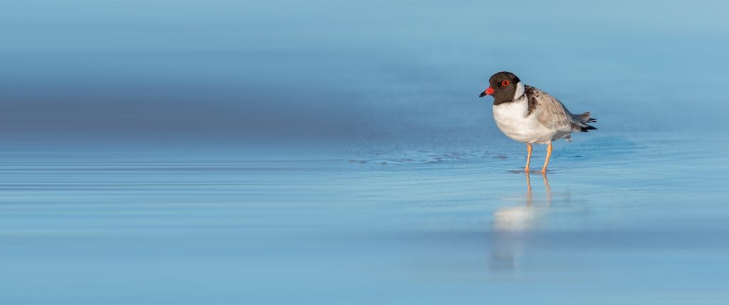
Sub-projects include protecting cultural values, controlling predators to protect wildlife, protecting threatened birds such as the Hooded Plover, revegetating riverbanks and improving water quality across the Powlett catchment.
West Gippsland CMA sees everyone in the catchment as part of the river’s future with opportunities to act as stewards to play a small or large role in caring for it.
“When you bring everyone together it creates a groundswell of possibility and the large task of taking action becomes bite-size and manageable – supported by each other. That’s how integrated catchment management works,” explained Deb Archer, Manager Catchment and Communities at the West Gippsland CMA.
The Kugerungmome/Powlett Partnerships project is funded as part of the Victorian Government’s Our Catchments, Our Communities program aiming to improve the health of waterways and catchments across regional Victoria.
West Gippsland CMA is responsible for over 40,000 kilometres of designated waterways across the region. All these waterways flow to the Victorian coast, discharging through the Gippsland Lakes, or directly into Bass Strait and the Southern Ocean.
Shoring up Blue Rock Lake’s popular walking track starts this summer
Visitors to Blue Rock Lake will benefit from new erosion control works that will protect the foreshore track – ensuring continued access and supporting the lake’s health.
The Blue Rock Lake Foreshore Stabilisation and Community Path Renewal Project will start in February 2026, when water levels at the lake are typically lower, to rehabilitate around 130 metres of eroded shoreline.
Funding of $43,000 from Regional Development Victoria’s Tiny Towns Fund will see large rocks placed adjacent to the track, creating a ‘beach’ that will protect the foreshore and track from further damage caused by wave action and weather.
Latrobe Catchment Landcare Network Project Officer Caroline Hammond said the track must be temporarily closed to complete the works.
“We will need to close the track for between seven to ten days, depending on the weather and appreciate the community’s patience as we work to complete the job quickly,” she said.
“We will notify the community and install signage and project information on notice boards at the lake and in the local area to keep residents and lake users updated,” she said.
This project is being delivered in partnership by Latrobe Catchment Landcare Network (LCLN), Southern Rural Water, West Gippsland Catchment Management Authority (the CMA), and the Tanjil Valley Landcare Group.
Caroline said this project will help protect the environmental and recreational values of Blue Rock Lake well into the future.
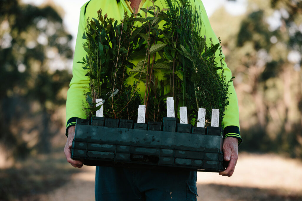
Once erosion control works are complete, Tanjil Valley Landcare Group will host a community planting day to revegetate the site with native riparian, ephemeral, and aquatic species.
The West Gippsland Catchment Management Authority Rivers and Wetlands Officer, Matt Khoury said these plantings will strengthen the foreshore, slow water impact, and create valuable fish habitat.
“This project will protect and improve access to this much-loved community space, while later next year native aquatic plants will be restored to the foreshore as new habitat for fish and wildlife,” said Matt.
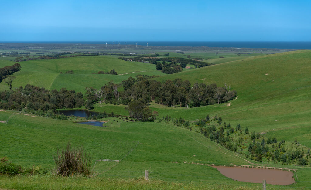
Past year shows strong returns for West Gippsland catchment
From mountain headwaters to the Bass Strait coast and Gippsland Lakes, West Gippsland Catchment Management Authority (CMA) adds to the catchment’s balance sheet every day and their latest Annual Report details the work that has put West Gippsland’s waterways on the right side of the leger for another year.
Every tree planted, kilometre of river fenced, hectare of weeds removed, wetland protected and event held for the community in 2024-25 is captured in the CMA’s latest Annual Report approved in State Parliament recently.
“This report is more than numbers, it’s our story and showcase of the overall effort across the catchment and we are extremely proud of every achievement,” says Martin Fuller, CEO of West Gippsland CMA.
“We are privileged to be trusted to deliver environmental initiatives for the region funded by the Victorian and Australian governments. Importantly we acknowledge the guidance of Traditional Owners, and support of partners and community to bring all these moving parts together.”
The report paints a compelling picture of the diverse work of the small, local organisation. Projects focus on catchment health and include restoring rivers and wetlands, managing estuaries, delivering water allocations for the environment and partnering with landholders on sustainable agricultural solutions and building resilience to the effects of climate change.
In 2024-25, the CMA delivered on many projects – each playing their part in building a healthy catchment for West Gippsland.
- Revegetated 204 hectares to restore rivers and habitat for wildlife including fish, platypus, birds and wallabies.
- Delivered 42,216 megalitres of water for the environment into rivers to mimic natural flows for fish to migrate and breed.
- Covered 31,084 hectares of pest animal control to protect endangered species such as Hooded Plovers.
- Protected 106 hectares of precious remnant vegetation and treated 1,194 hectares of weeds to allow native plants to
re-establish and thrive. - Worked with 44 valued partners to amplify their efforts and because we can’t do it alone.
- Held events for 2,330 community members and partners to share knowledge and build skills.
- Provided 938 responses for farm plans, flood and other advice and planning permits.
“Many people are not sure of the breadth of work of the CMAs and this report demonstrated the broad range of benefits CMAs bring to the table for everyone,” Martin concluded.
About the river lovers at West Gippsland CMA
West Gippsland Catchment Management Authority (the CMA) is responsible for over 40,000 kilometres of designated waterways across the region. All these waterways flow to the Victorian coast, discharging through the Gippsland Lakes, or directly into Bass Strait and the Southern Ocean.
Become a river lover
Find out more about the work we do and sign up to our e-news for updates
This work ultimately flows on to a more healthy and resilient home for wildlife and the West Gippsland community.

Seasons greetings – office hours
Our offices will be closed for the festive season from Tuesday 23 December 2025 and will reopen on Monday 5 January 2026.
We hope you enjoy getting out and about in the catchment for some relaxing days.
Wishing you all a very merry catchment Christmas and a safe, happy and healthy New Year.
Learn about the science and benefits of Enhancing Farm Dams Field Day
Join us for a field day at Wilandra Farms in Clydebank to learn about the science and benefits of enhancing farm dams.
West Gippsland Catchment Management Authority is excited to bring experts from Australian National University’s Sustainable Farms initiative to our region.
Ecologists Amber Croft and Angelina Siegrist will share their research on the benefits of enhancing farm dams for water quality, water security and biodiversity.
The field day will include:
- Visiting a fenced dam on the property of Wilco Droppert and Sandra Jefford to hear about the enhancement work they have done
- The latest scientific research on the benefits of enhancing dams for biodiversity, water quality and water security
- Practical advice on ways to enhance farm dams.
This informative, practical field day is for farmers and landholders interested in making their dams resilient in a changing climate.
This is a free event, but registration is essential.
Date: Wednesday 26 November 2025
Time: 10.00am – 12.30pm
Location: Wilandra Farms, Punt Lane, Clydebank Vic 3851
Cost: Free (lunch provided)
If you have any questions about this event please contact Sam Shannon at sams@wgcma.vic.gov.au or 0409 944 114.
This event is part of our Climate Smart Farming program, supporting Gippsland farmers to adopt sustainable agriculture practices that benefit farming, the environment and the bottom line.
Partners:
Funders:
This event is supported by the Australian Government through funding from the Natural Heritage Trust under the Climate-Smart Agriculture Program.
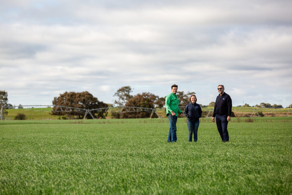
Shelterbelts for livestock – Farm Field Day event
Join us for this farm field day to hear from experts how shelterbelts can increase farm production, improve biodiversity, reduce your carbon footprint and diversify income through agroforestry.
Hear firsthand practical tips from the farmers who have planted extensive shelterbelts across their cattle properties.
Learn about shelterbelt design, tree species selection and funding opportunities including the Victorian Trees on Farm program.
Date: Tuesday 2 December 2025
Time: 10.00am to 12.30pm
Location: Bushy Park
Cost: Free (lunch provided)
If you have any questions about this event, please contact Sam Shannon at sams@wgcma.vic.gov.au or call 0409 944 114.
Partners:
This event is one of a series of workshops offered under our Carbon Farming Outreach Program, which provides free training for farmers across the West Gippsland catchment to better understand their emissions and learn the benefits of carbon farming.
Funders:
The Victorian Carbon Farming Outreach Program is delivered with funding support from the Commonwealth of Australia through the Department of Climate Change, Energy, the Environment and Water under the National Carbon Farming Outreach Program. The Program is delivered through a partnership between Agriculture Victoria, 10 Catchment Management Authorities and Landcare Victoria and other bodies.