Estuaries are an important link between the ocean and land…
A meeting place where fresh water from rivers and streams mixes with salty marine waters. Estuaries are dependent on both of these water sources to provide a diverse and healthy environment.
Estuaries in our region
The coastline of our region extends eastward from Kilcunda to Hollands Landing and takes in part of the Ramsar listed Gippsland Lakes and Corner Inlet. The estuaries in our catchment area range from pristine to highly modified. The following estuaries are in our region.
- Bourne Creek, Powlett River, Coal Creek, Wreck Creek
- Ayr Creek, Screw Creek, Anderson Inlet
- Darby River, Tidal River and estuaries of Corner Inlet and the east side of Wilsons Promontory
- Merriman Creek
- estuarine reaches of rivers that enter into Lake Wellington
A brief summary of the location, traits and background to the main estuaries in the WGCMA Catchment.
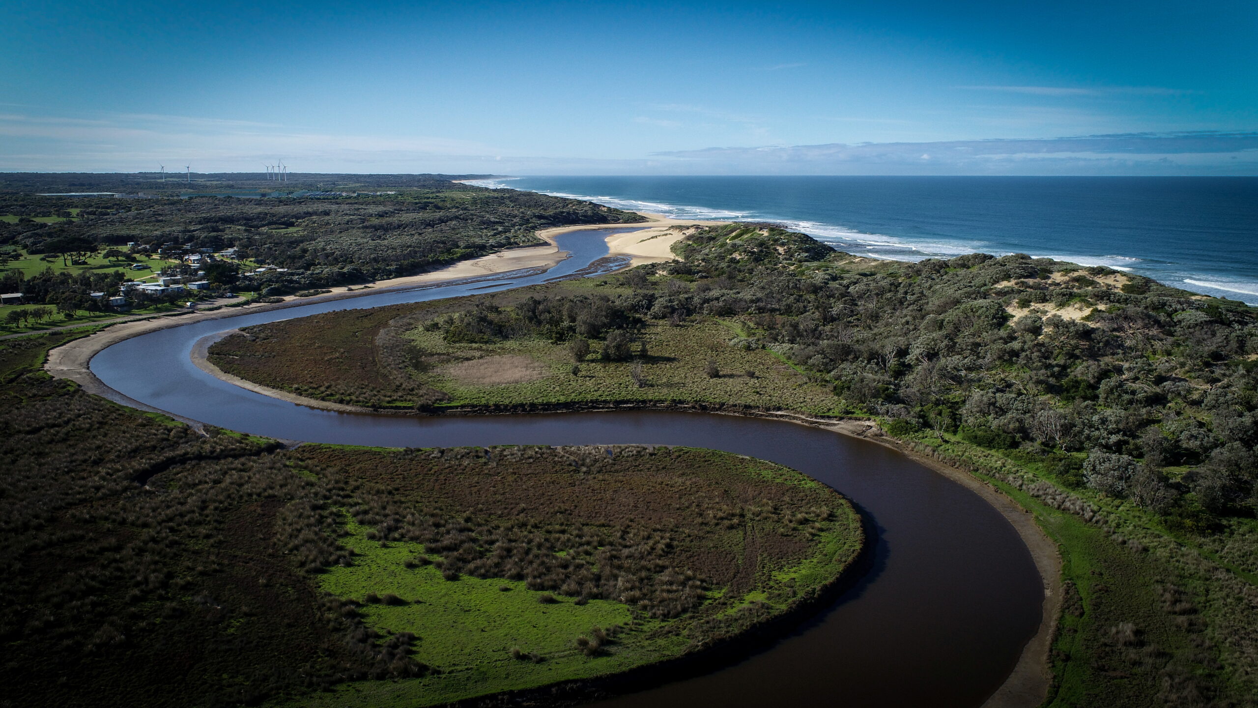
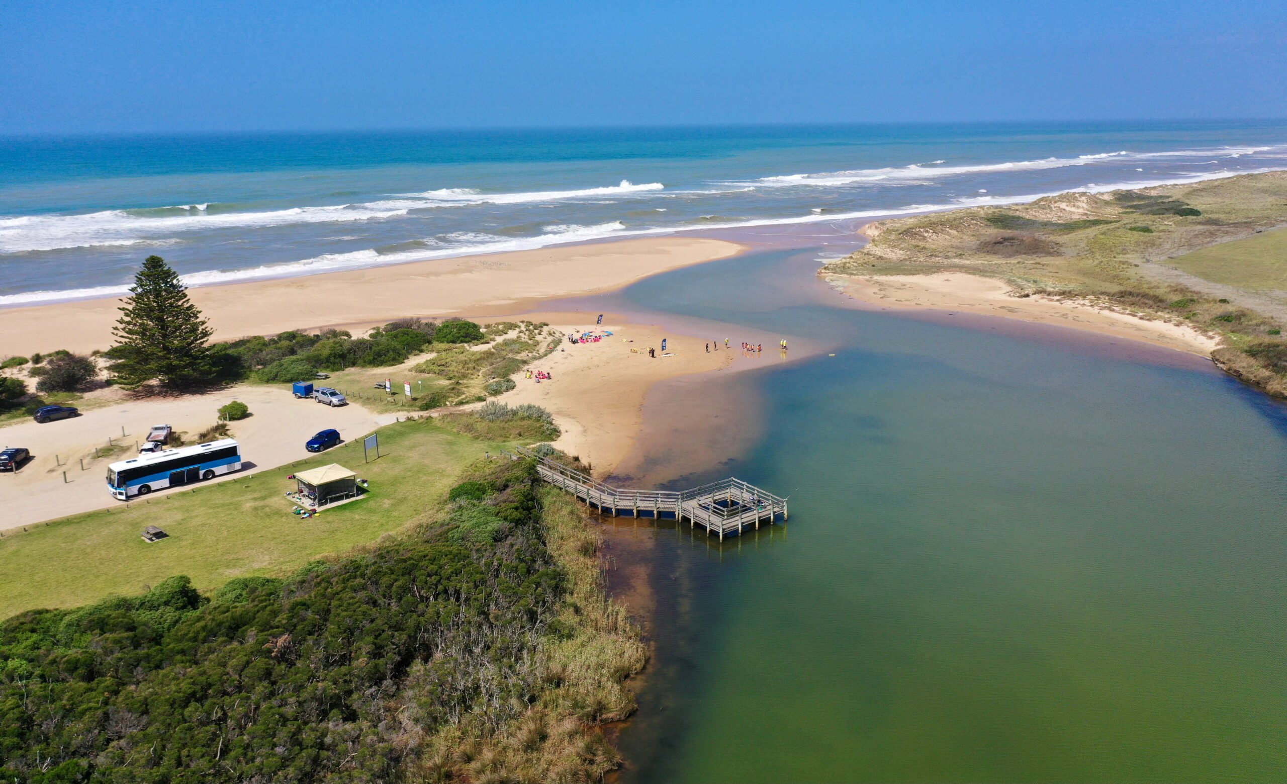
The Powlett River estuary is perhaps one of the most loved of all the estuaries in the WGCMA region. This affection is reflective of the Powlett’s significant environmental, cultural, social and economic values.
Located in the Bass Coast local government area, approximately 130 kilometres from Melbourne the Powlett estuary lies between Kilcunda and Dalyston. The rivers headwaters are in the Strzelecki Ranges near Korumburra, and it flows generally south west towards the coast between Kilcunda and Wonthaggi.
It is listed as a Nationally Important Wetland due to its extensive saltmarsh and wetland communities and heritage values. It also provides habitat for the critically endangered, Orange-bellied Parrot.
The estuary mouth tends to close in autumn and open in spring following rain events in the catchment. However, given variability caused by climate change these timings are becoming less certain with the potential for longer periods of closure resulting in greater impact on landholders.
Requests for openings is most sought by landholders as inundation can affect access to property and agricultural productivity. To date, WGCMA have been proactively managing artificial opening events alongside partners to minimise risks to the environment while balancing social, cultural and economic values.
The Powlett River Estuary is a priority waterway for the West Gippsland Region and will continue to be throughout the immediate future. This will include ongoing monitoring as well as active management of the waterway and liaison with local landholders, traditional owners, local government and other interested parties to achieve agreed environmental goals.

Located within the township of Inverloch, Wreck Creek is a highly modified system with two major creek branches.
The western branch begins above the RACV resort and flows through and sometimes meets the Eastern branch behind the foredune at the Inverloch Surf Beach.
The Eastern branch receives requests for artificial openings due to inundation risks to private property. The Eastern branch flows through the western end of the Inverloch township, much of which has been residentially developed and urbanised.
After severe coastal storms in 2020, the Wreck Creek eastern branch formed a new opening that intersects across Parks Victoria land. It is unknown at this time if the creek mouth will move again in quieter coastal conditions.
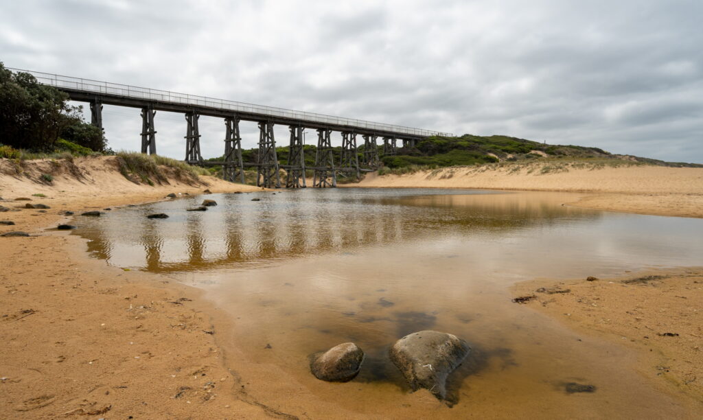
Located on the outskirts of Kilcunda, Bourne Creek flows through farmland and out to sea, at the Kilcunda surf beach.
Notably, the creek flows under the iconic historic Kilcunda trestle railway bridge, which forms part of the local rail trail.
The catchment is small and can close on a semi-annual basis and contains a small wetland located near the mouth.
Bourne Creek is part of the Kilcunda Creek catchment with the headwaters starting up at the Kilcunda Ridge Road in the Woolamai area.
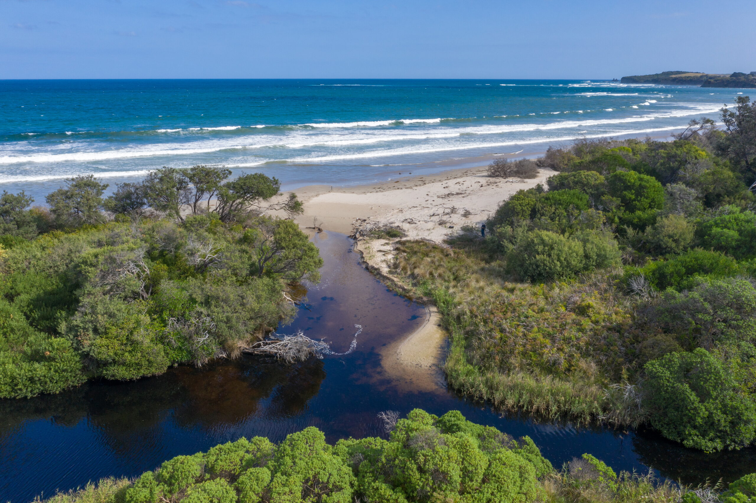
Ayr Creek, like Wreck Creek, is a small waterway that flows through the township of Inverloch. However, it is also different as the creek is vegetated and does not flood any nearby properites or other public and private assets.
With the current tide and movement through Anderson Inlet, Ayr Creek can close and can become a large lagoon with significant amounts of sand built up around the entrance.
The stormy weather of 2020 saw the lagoon open in the winter months and it has remained so since.
Being located so close to a major coastal town in Inverloch a significant amount of community engagement has occurred with the Bass Coast Shire conducting public sessions were held to explain to the public the dynamics and role the estuary plays in the broader ecosystem.
Bass Coast Shire has a management reserve plan for Ayr Creek.
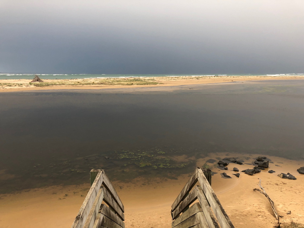
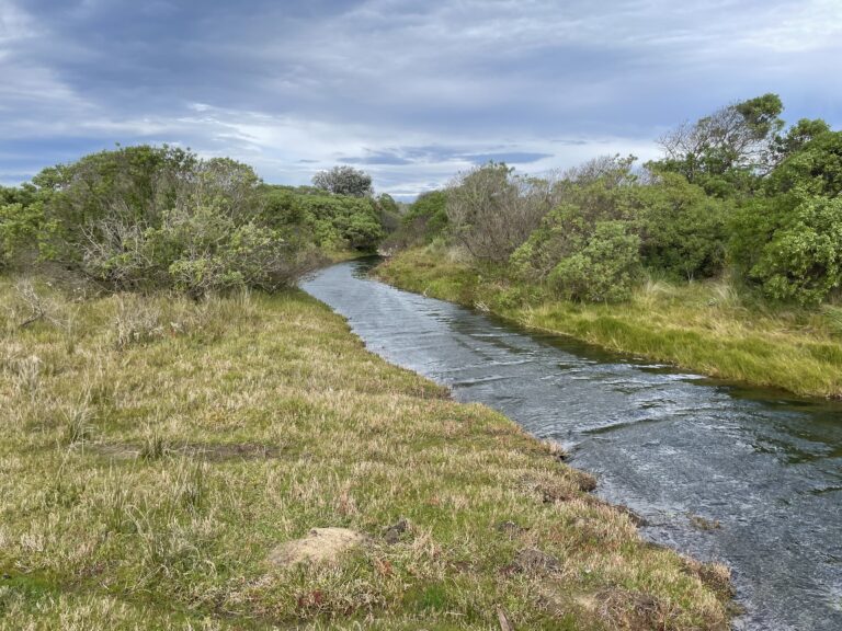
Located in the Wellington Shire, Merriman Creek flows east from the Strzelecki Hills and out to sea on the edge of the township of Seaspray.
The estuary has significant social and economic values and Gunaikurnai Land and Waters Aboriginal Corporation, have installed some signage around the town explaining its cultural significance.
Recreationally, fishing, kayaking, boating and swimming are prominent activities. Merriman Creek estuary is listed as a priority waterway in the current Regional Water Strategy and in the Regional Catchment Strategy.
Wellington Shire updated its flood study for the area which was supported by the WGCMA Statutory Team in 2016. It should be noted that as part of this study, the flooding risk from the ocean was considered minimal and only if the estuary berm cannot be breach. The scope of climate change was not considered extensively as part of this study.
As our coastlines experience more effects from climate change, there is likely to be increased emerging threats for the Merriman Creek estuary. Increased variability in rainfall may extend the duration of closure for Merriman Creek estuary under low flow conditions.
Jack Smith Lake is known as an ephemeral system which is dry most years.
It is listed as a Nationally Important Wetland and is home to many threatened fauna species.
While the wetland and estuary area contain many natural, cultural and social values it is a reserve and inherently protected from agriculture and infrastructure development.
The major threat to environmental and cultural assets are campers and day trippers who drive their vehicles off tracks, across the sand dunes damaging habitat in the process.
Should an estuary be opened or closed?
Many of Victoria’s estuaries close from time to time as part of a natural process. This is important for supporting estuary ecosystems, plants and animals. Under some conditions, artificial estuary openings are considered to manage the risk of flooding to built infrastructure and agriculture land.
This Estuary Low Flows Fact sheet has been developed by Victoria’s Coastal Catchment Management Authorities, to provide further insight into how estuaries function in low flow periods.