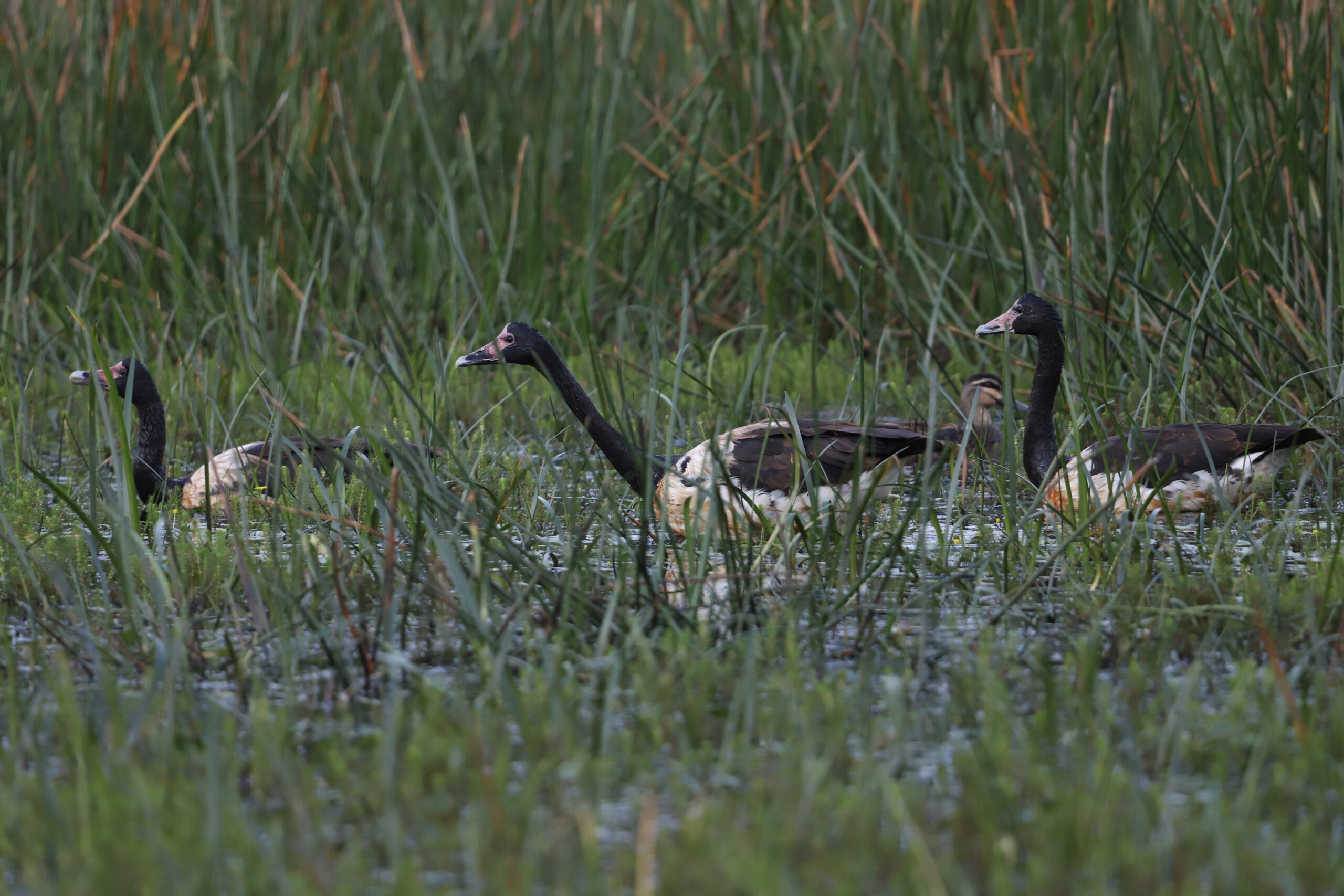
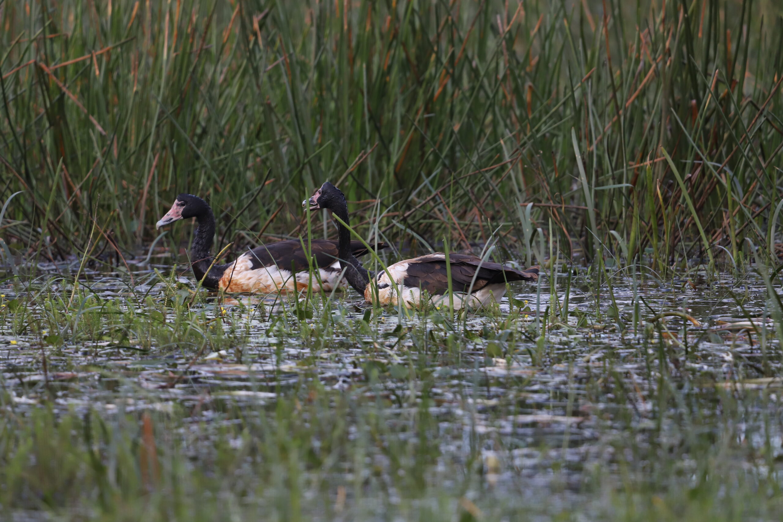
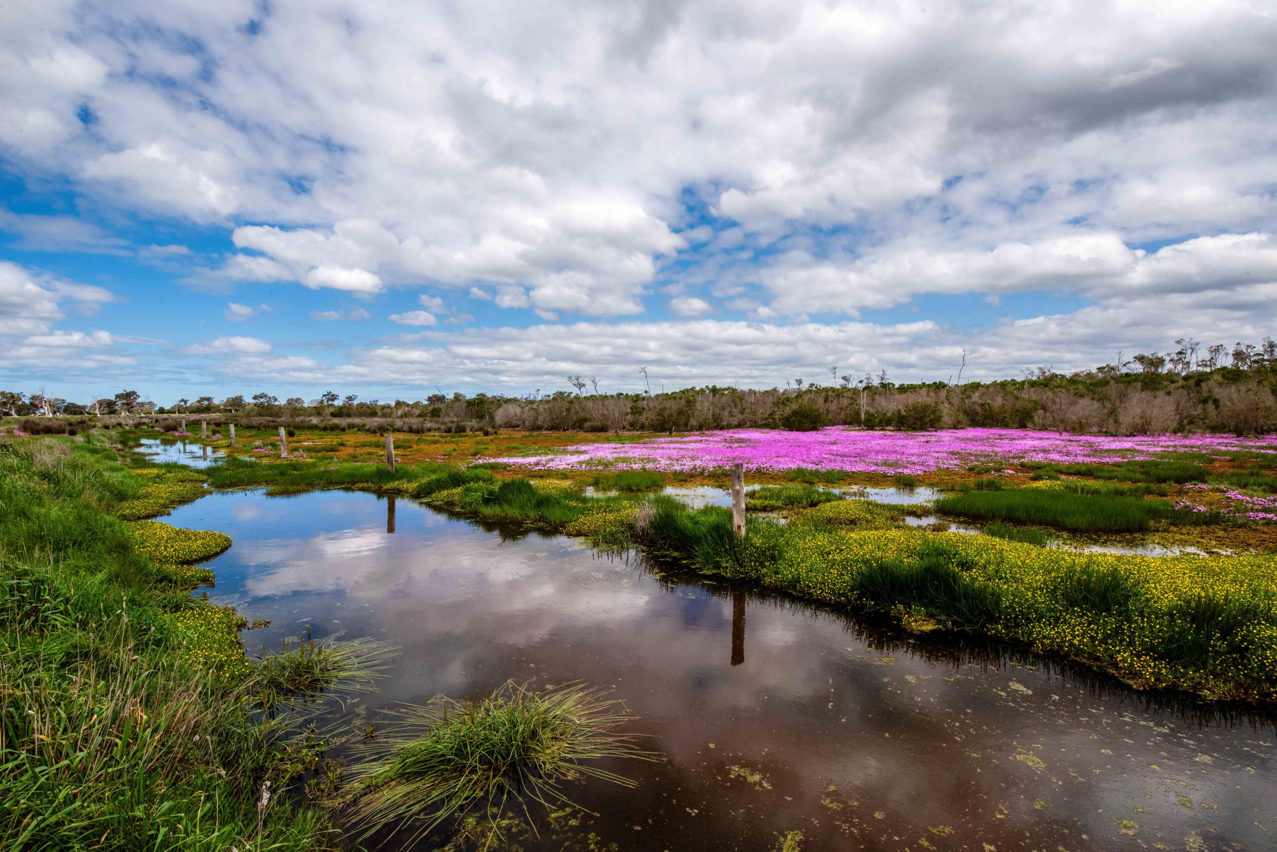
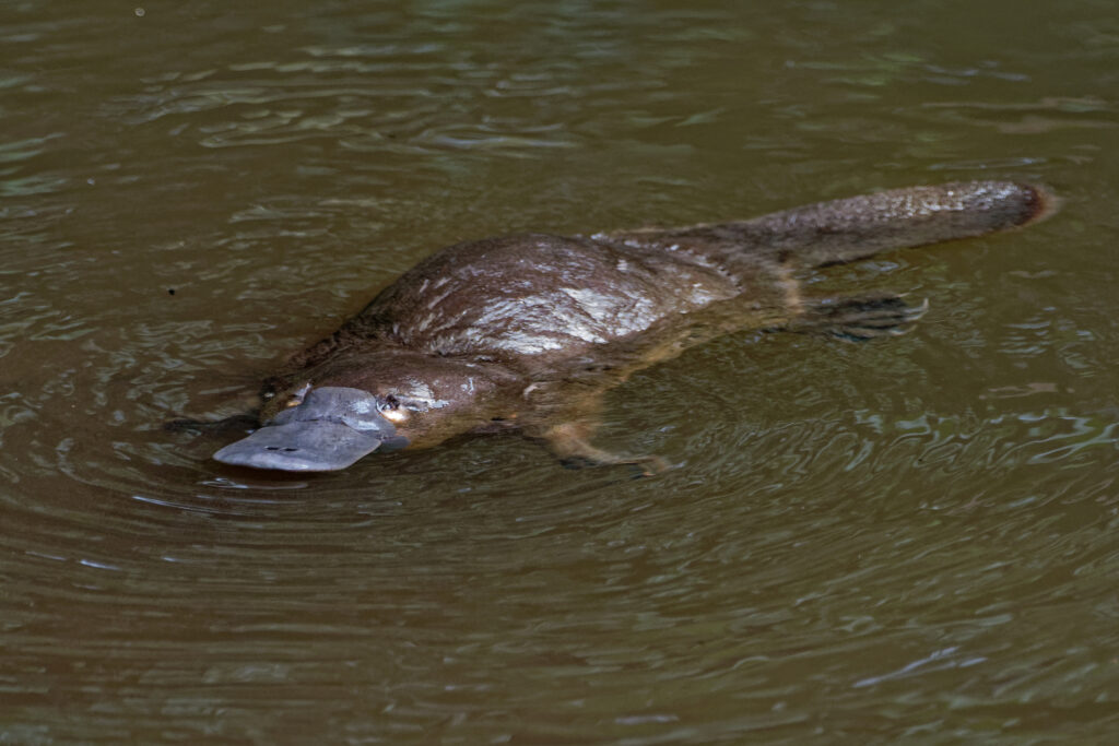
Rare magpie geese visit Gippsland Lakes
Two rare sightings of Magpie Geese have been confirmed on across the Gippsland Lakes catchment in both Maffra and Bairnsdale.
“We are excited about these sightings of Magpie Geese visiting Gippsland,” said Sean Phillipson, Senior NRM Advisor for East Gippsland Catchment Management Authority.
The birds are found on floodplains and in freshwater wetland areas across coastal northern and eastern Australia but are a rare visitor to Victoria where their conservation status is listed as Vulnerable.
Passionate field naturalist Duncan Fraser, a resident in the Maffra-Newry area since 1945, spotted three birds near Newry Creek. A member of the public reported a further three Magpie Geese in Bairnsdale with East Gippsland CMA confirming both sightings and also that they were two separate groups of geese.
“Magpie geese were once widespread across freshwater wetlands of Gippsland and Victoria but historic over-hunting, draining of wetlands and intensification of agriculture changed this,” said Mr Phillipson.
“The birds in Bairnsdale looked to be sub-adults and could be using the area as a stopover refuge. Magpie Geese often form breeding groups of three – two females and one male.”
Magpie Geese need freshwater wetlands and aquatic vegetation to survive.
“These sightings demonstrate that wetlands and vegetation around the Lakes are acting as a refuge and that the right habitat can be an important place for our wildlife – no matter how small.”
“These rare visitors are something we can all celebrate and are a result of the combined effort to enhance and protect the health of the wetlands around the Lakes,” concluded Mr Phillipson.
You can help
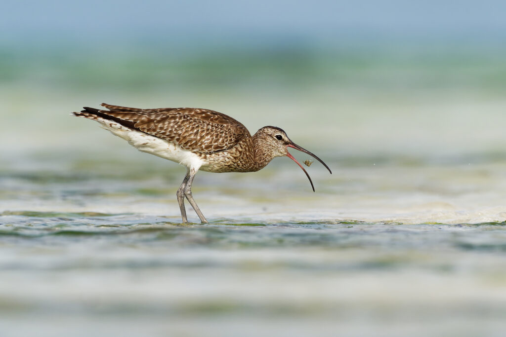
- Magpie Geese are large black and white birds with a red beak. If you see any Magpie Geese, we would love you to log the sighting with BirdData either online or via the app.
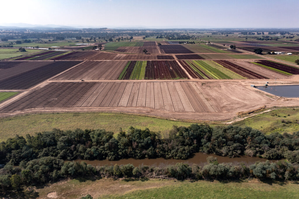
Home to the smallest of fish through to the largest of birds, Gippsland Lakes on Gunaikurnai Country covers 60,000 hectares and are home to around 400 indigenous plants, 300 native wildlife species and are recognised as a feeding ground for migratory birds that travel from as far away as Siberia. That is why they are one of 67 wetlands in Australia listed under the Convention on Wetlands of International Importance (Ramsar Convention).
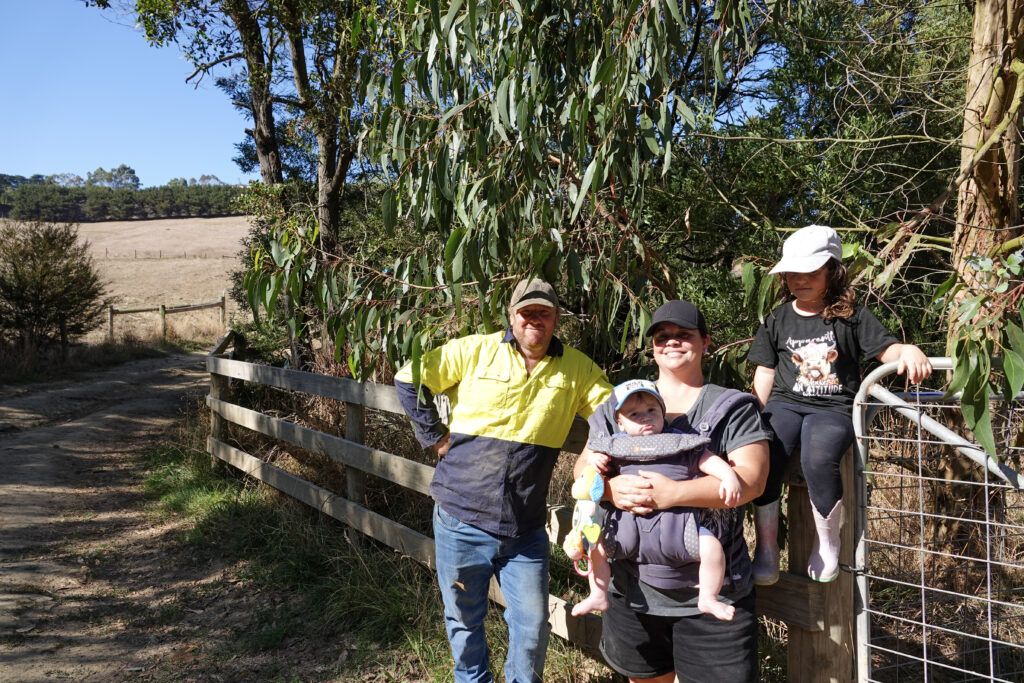
From barren to beautiful thanks to a farm fence
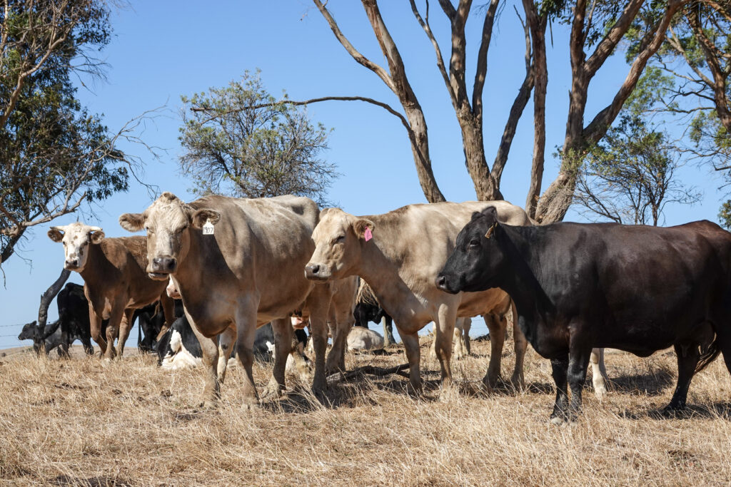
A fencing grant from West Gippsland Catchment Management Authority (the CMA) and partners has helped transform a local beef farm into a tranquil landscape filled with birds and wildlife – all while protecting its prize asset – the cows.
In 2017, Brent and Amy Richardson were staring at an empty landscape on their 116 acre property in Ryanston, where they run Blue Gum Beef.
“It was barren – barely any trees or wildlife,” said Amy.
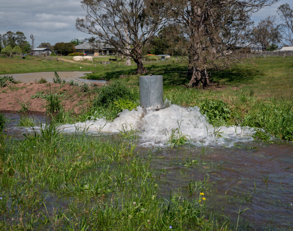
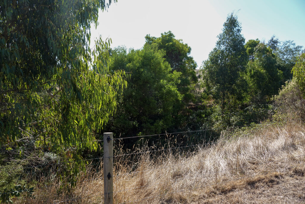
With no fencing or vegetation along the one and a half kilometre stretch of Archies Creek that runs through their farm, cattle were getting into the creek and causing problems.
“They were trampling on the banks and causing erosion, which was a hazard for calves who’d roll down the steep banks and get stuck,” explained Brent. “I was always having to check the creek for stranded calves and often they’d be rejected by their mother, so we’d then have to hand rear them. It was extra work.”
Thanks to a tip from his stock agent, Brent successfully applied for a farm fencing grant on offer by the CMA and partners at the time. The grant covered the cost of material for three kilometres of fencing, which he installed in sections over the next two years. Bass Coast Landcare Network chipped in to help spray the weeds before rolling up their sleeves to assist in planting a total of 10,000 native trees, shrubs and grasses along the creek bank.
Today, the riparian zone along the creek is unrecognisable, with tall trees and a thick, lush understory teeming with birds and wildlife.
“We initially wanted fences along the creek to keep the cattle out, but it’s been so much better than that,” said Brent. “The vegetation has flourished, wildlife has returned and the entire area is more tranquil. It’s lifted the whole property.”
Amy agrees: “So much goodness has come of this work. You can hear the birds now – we never had that before. We’ve seen echidnas, wombats, possums – even eagles. The whole process was great, and I highly recommend it to anyone wanting to re-establish ecosystems on their property.”
The CMA is pleased to continue supporting farmers with the costs of fencing to protect biodiversity through our Climate Smart Farmers project. More information about this initiative will be available soon.
Muck and money – making the most of manure
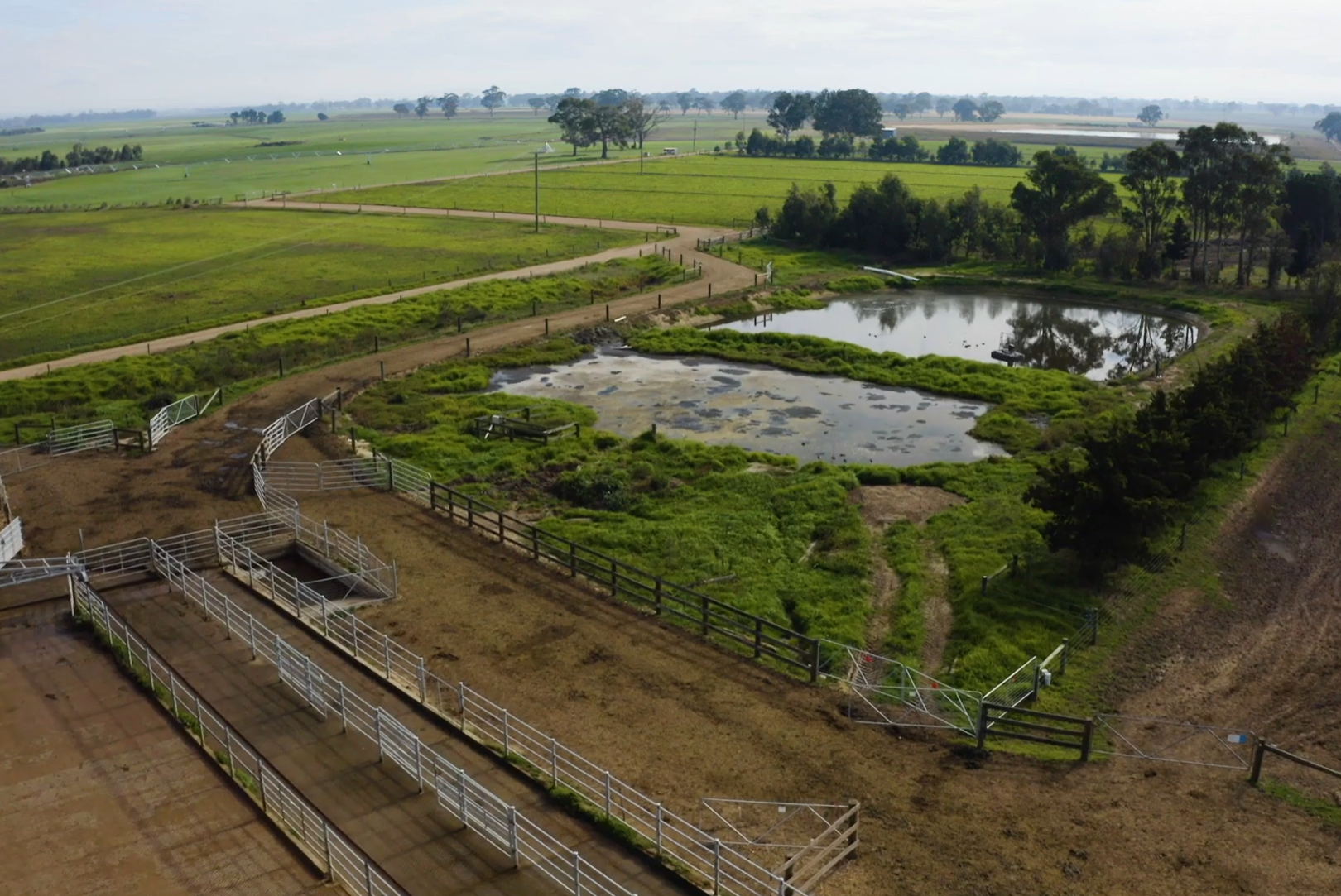
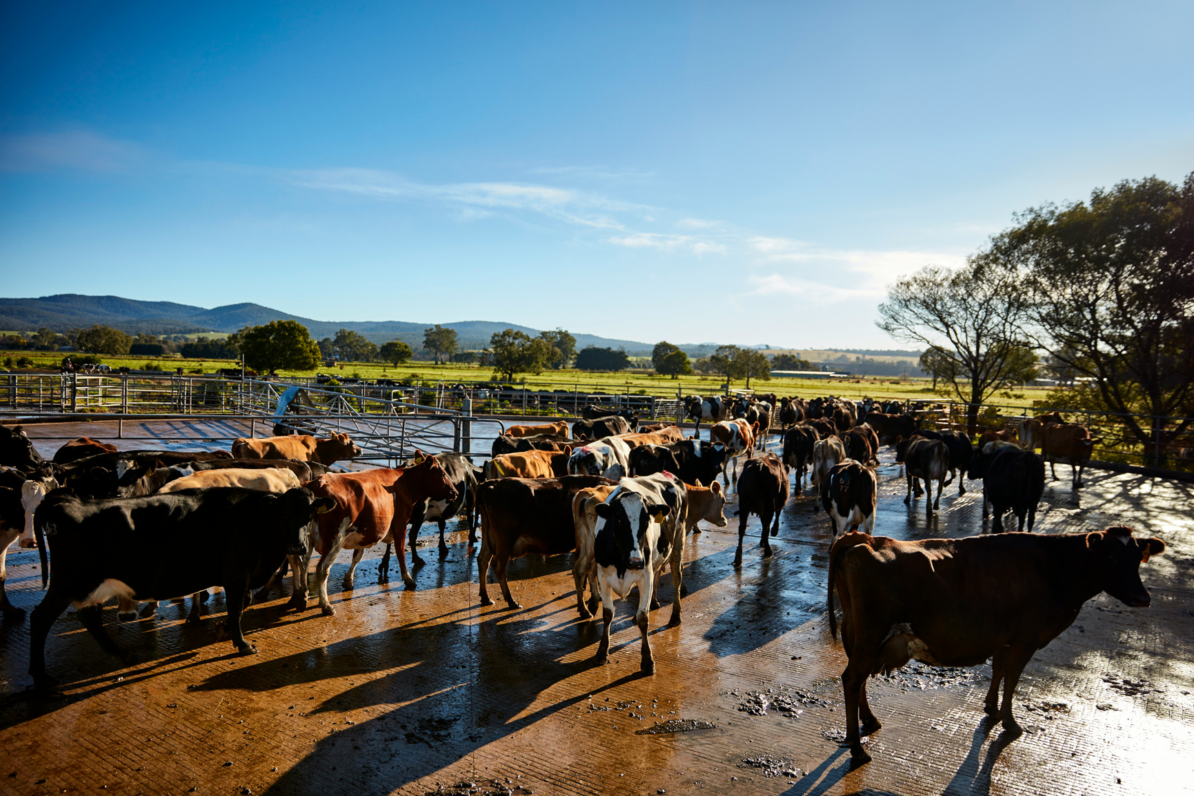
Farmers are set to make the most of manure thanks to new funding for local dairy farmers.
West Gippsland Catchment Management Authority (CMA) and GippsDairy are inviting expressions of interest from dairy farmers in the Macalister Irrigation Area (MIA) to join a project aimed at boosting the benefits of effluent on farm and ultimately reducing effluent entering the Gippsland Lakes.
Up to 15 dairy farmers will have the opportunity to work with a qualified agronomist to develop a Nutrient and Effluent Management Plan and introduce innovations to better utilise effluent nutrients to improve production, save money and protect the environment.
“By maximising the use of effluent across the farm, farmers can improve soil health by having to apply less synthetic fertiliser, saving money and emissions,” said Anthony Goode – Sustainable Agriculture Program Coordinator for West Gippsland CMA.
“We know dairy effluent is a highly valuable source of nutrients, particularly nitrogen and phosphorous. Farmers who effectively keep these nutrients on farm are not only improving their soils and pasture for cattle, they’re also protecting local waterways which ultimately flow into the Gippsland Lakes Ramsar listed wetlands,” explained Anthony.
The project aims to help farmers increase the area of effluent distribution on their farms by providing customised advice and practical support to upgrade infrastructure and improve effluent management practices.
Each Nutrient and Effluent Management Plan developed will clearly identify key recommendations that will improve effluent management decisions. The plans will use soil test data to advise on future nutrient application rates across the farm and how best to achieve this.
Participating farmers will receive funding to support the cost of implementing the recommended actions from the plan, such as upgrades to mains pipelines or effluent ponds.
“We’ve been partnering with farmers for over 25 years to drive sustainable agriculture practices in the region and this project is another great example of working together for the benefit of farming and the overall health of the catchment,” concluded Anthony.
How to apply
Expressions of interest opened at 9am Sunday 1 June and closed at 5pm Monday 16 June 2025.
Grants will be allocated to 15 eligible applicants on a first-come, first-served basis.
If you have any questions, please email dairy@wgcma.vic.gov.au
This project is supported by the Australian Government through funding from the Natural Heritage Trust under the Climate-Smart Agriculture Program.
West Gippsland CMA is responsible for over 40,000 kilometres of designated waterways across the region and delivers programs for healthy and resilient catchments. All these waterways flow to the Victorian coast, discharging through the Gippsland Lakes, or directly into Bass Strait and the Southern Ocean.
Become a river lover
Find out more about the work we do and sign up to our e-news for updates.
Page updated 16 June 2025
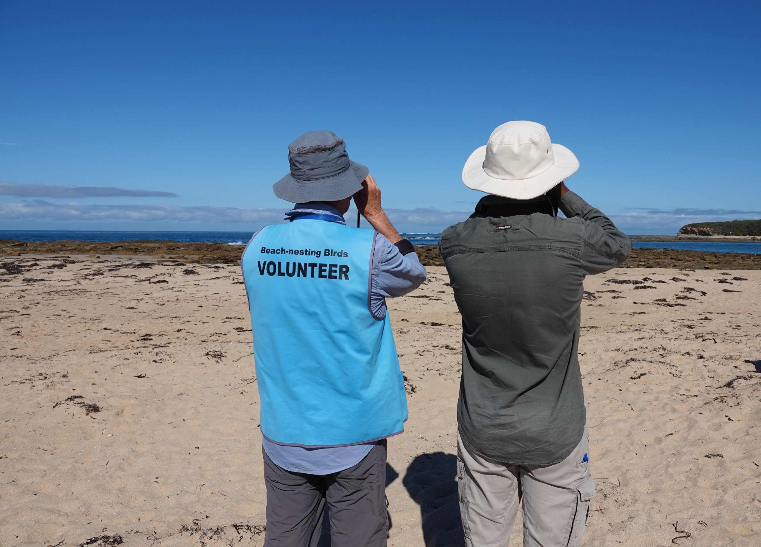
Not on our watch: saving a species from extinction, one walk at a time
Every day over summer David Hartney goes for a walk along the beach at Cape Paterson. He takes his time, observing the changes in the dunes, the telltale tracks of wildlife, the rise and swell of the tide.
He recognises a single, tiny track in the sand. ‘KK’ has been here. He can’t see her but knows she’s around. Just like he knows that ‘DH’ now lives in Sandy Point and ‘EZ’, despite an injury, made it all the way to Lorne.
He knows because he’s been tracking these beaches for five years.
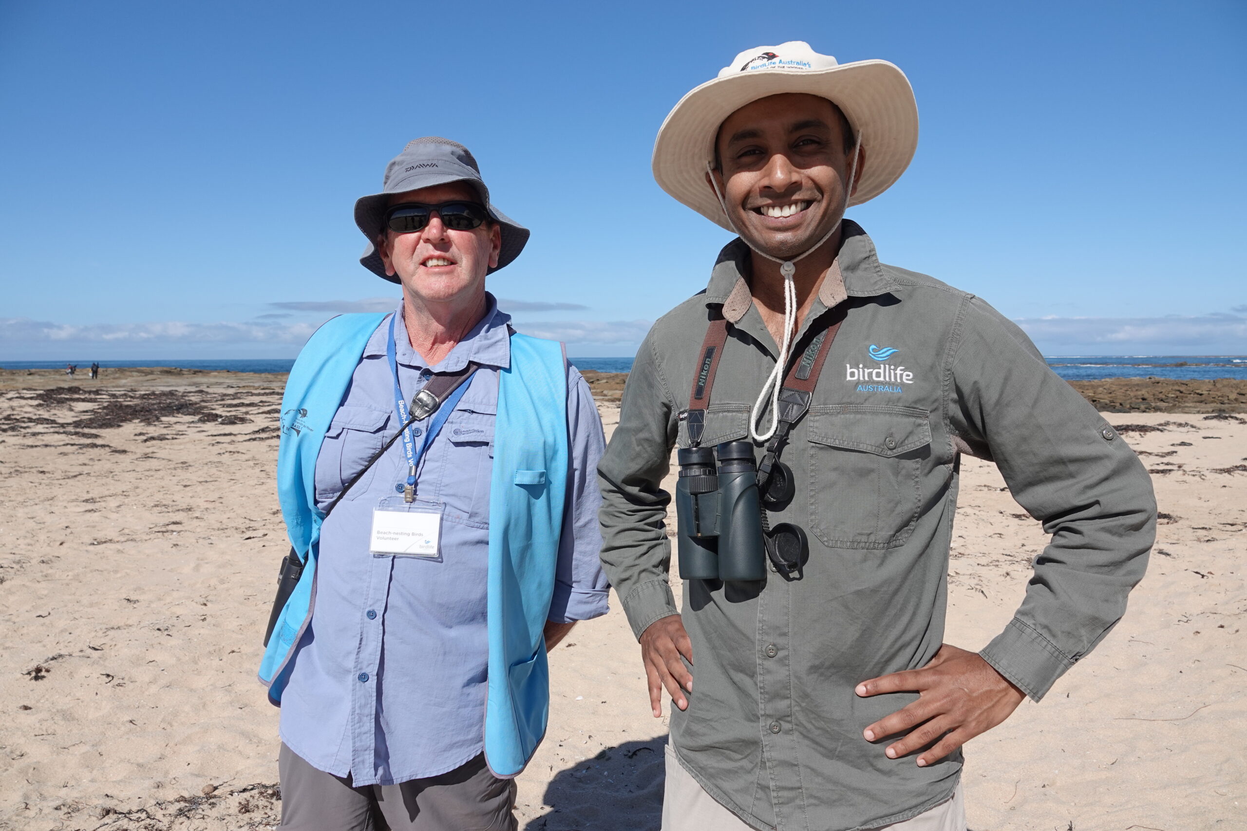
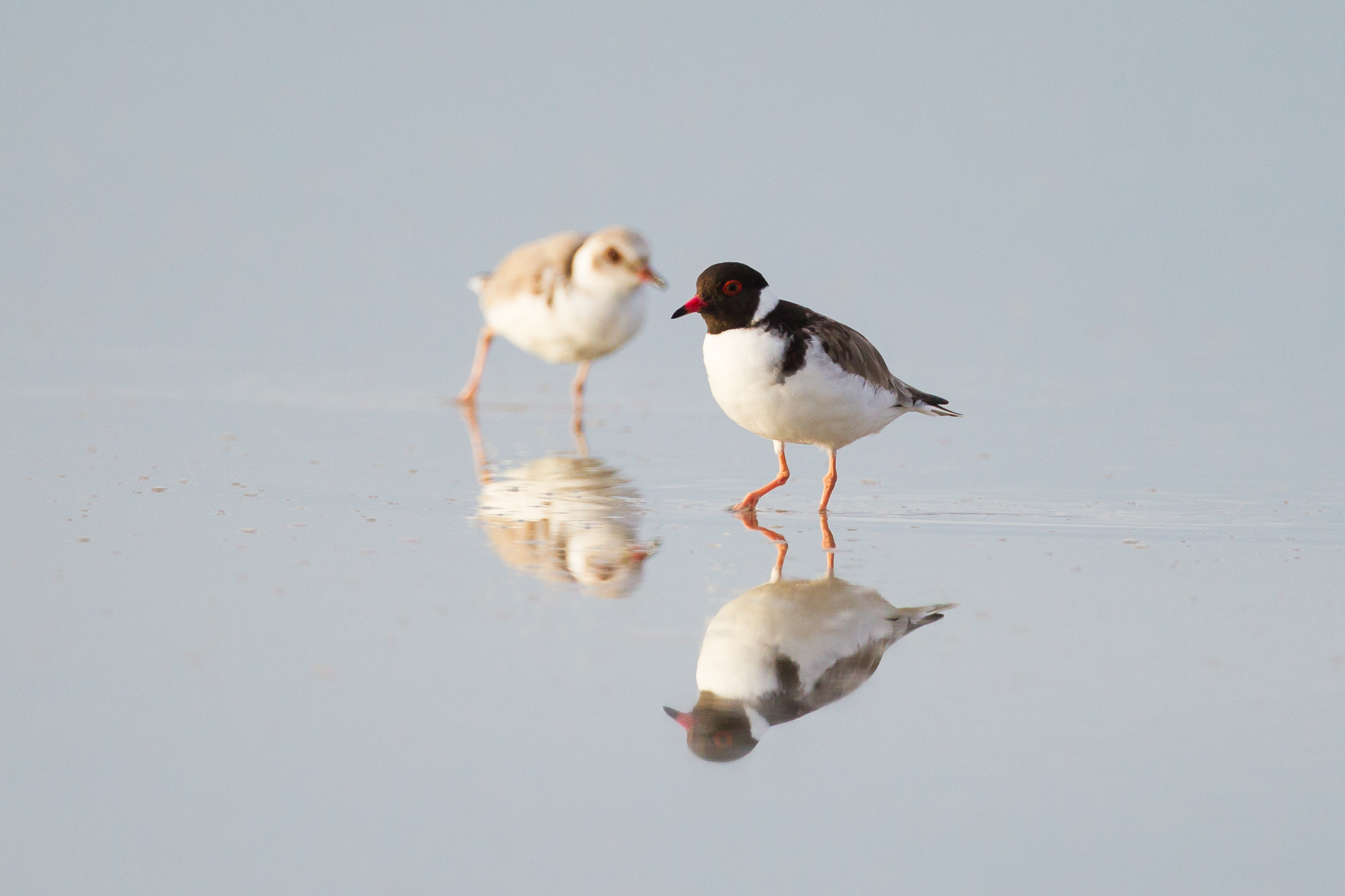
EZ, DH and KK, aka ‘Stumpy’ are Hooded Plovers, and their lives – from chick to fledgling to breeding adult – are recorded by David and a tribe of volunteers who take to the beaches during the spring-summer breeding season to help save this threatened species from extinction.
Tough, tenacious and resilient is how he describes the tiny, beach-nesting birds who must battle people, pets, storms and predators to raise their chicks.
“We have a lovely little bird named KK, known as Stumpy because she’s got one foot missing. That bird is 15 years old and has introduced five fledglings into the population over her life. You know she’s around because she’s got a very distinctive footprint,” David said.
By banding the birds with tags that identify them, Friends of the Hooded Plovers volunteers provide valuable data to BirdLife Australia and help with efforts to improve the unacceptably low survival rates of chicks.
“The fact that these birds only nest on beaches during spring and summer presents them with huge challenges,” explained Kasun Ekanayake, ‘Hooded Plover guru’ and Beach-nesting Birds Project Coordinator at BirdLife Australia.
“The beaches are really busy with people and dogs. Then there are predators like foxes and feral cats to contend with. Because of these challenges, the birds suffer a lot of breeding failure. That’s why we stepped in and got volunteers in local communities involved in the conservation of this species.”
David’s team focuses on a stretch of beach between San Remo and Inverloch – home to Victoria’s second highest population of Hooded Plovers.
He’s passionate about his role, not only for the local hoodies on his watch but what their survival means for the health of the beach environment that he’s so closely connected to.
“The Hooded Plovers are like the canary in the coalmine. If we lose this species I think it’s a sad indictment on our society and communities that these birds haven’t been able to survive in coexistence with us,” he said.
BirdLife Australia and Bunurong Land Council Aboriginal Corporation, Bass Coast Landcare Network, South Gippsland Landcare and Parks Victoria on a four-year project to help the survival of the region’s Hooded Plover population.
Toward Zero Extinctions: Protect the Eastern Hooded Plover is a $1.5 million dollar project aimed at protecting nests during breeding season, controlling foxes and other introduced pests, and engaging the community about the plight of the plover – and how they can help its survival.
To learn more, tune into the latest episode of Gippslandscapes podcast, where Kasun and David take a walk along Cape Paterson beach on the Bunurong Coast to check-in on the resident Hoodies and chat about what it means to be a Hoodie lover.
This project is funded by the Australian Government Natural Heritage Trust and delivered by West Gippsland CMA, a member of the Commonwealth Regional Delivery Partners panel.

Call to unite for reconciliation
National Reconciliation Week 27 May – 3 June is a time for everyone to learn about our shared histories, cultures, and achievements, and to explore how each of us can contribute to achieving reconciliation in Australia.
This year the theme of Bridging Now to Next, reflects the ongoing connection between past, present and future and asks us all to step forward together, to look ahead and continue the push forward as past lessons guide us.
Bass Coast Reconciliation Network (the Network) acknowledges National Reconciliation Week each year with member organisations hosting events at their workplaces for their teams with some open to all community members to attend.
National Reconciliation Week is bookended by two significant milestones in the reconciliation journey – the successful 1967 referendum when Australians voted to remove clauses in the Australian Constitution that discriminated against Aboriginal and Torres Strait Islander peoples, and the 1992 Mabo decision when the High Court of Australia recognised native title – the recognition that Aboriginal and Torres Strait Islander peoples’ rights over their lands did survive British colonisation.
“We all have a role to play when it comes to reconciliation, and in playing our part we collectively build relationships and communities that value Aboriginal and Torres Strait Islander peoples, histories, cultures, and futures,” said co-Chair of the Network, Dr Bev Munro.
The day before National Reconciliation Week, 26 May, is National Sorry Day commemorated nationally to remember and honour the Stolen Generations.
Public events happening across Bass Coast to acknowledge the week include a program of free First Nations films and Story Times at your local Myli Library, a special free screening of “Off Country” at Berninneit, Cowes and celebrating the launch of Bass Coast Health’s Reconciliation Action Plan on Wednesday 28 May in Wonthaggi.
“Across Bass Coast, organisations are acknowledging National Reconciliation Week in their workplaces, schools and communities and everyone is encouraged to join in and show their support,” said Dr Munro.
Find out more and join the events happening across West Gippsland for National Reconciliation Week here and at your local Shire website.
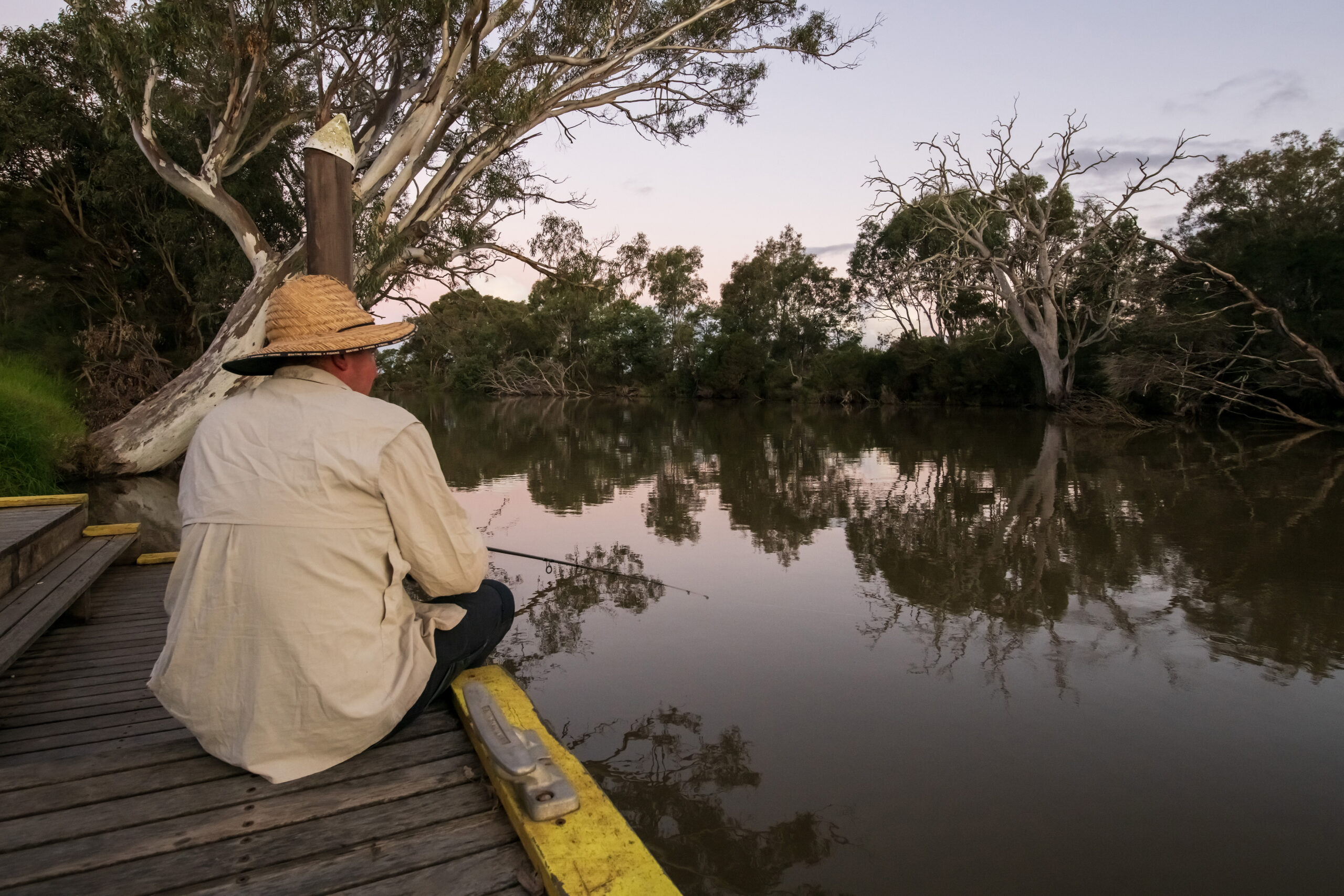
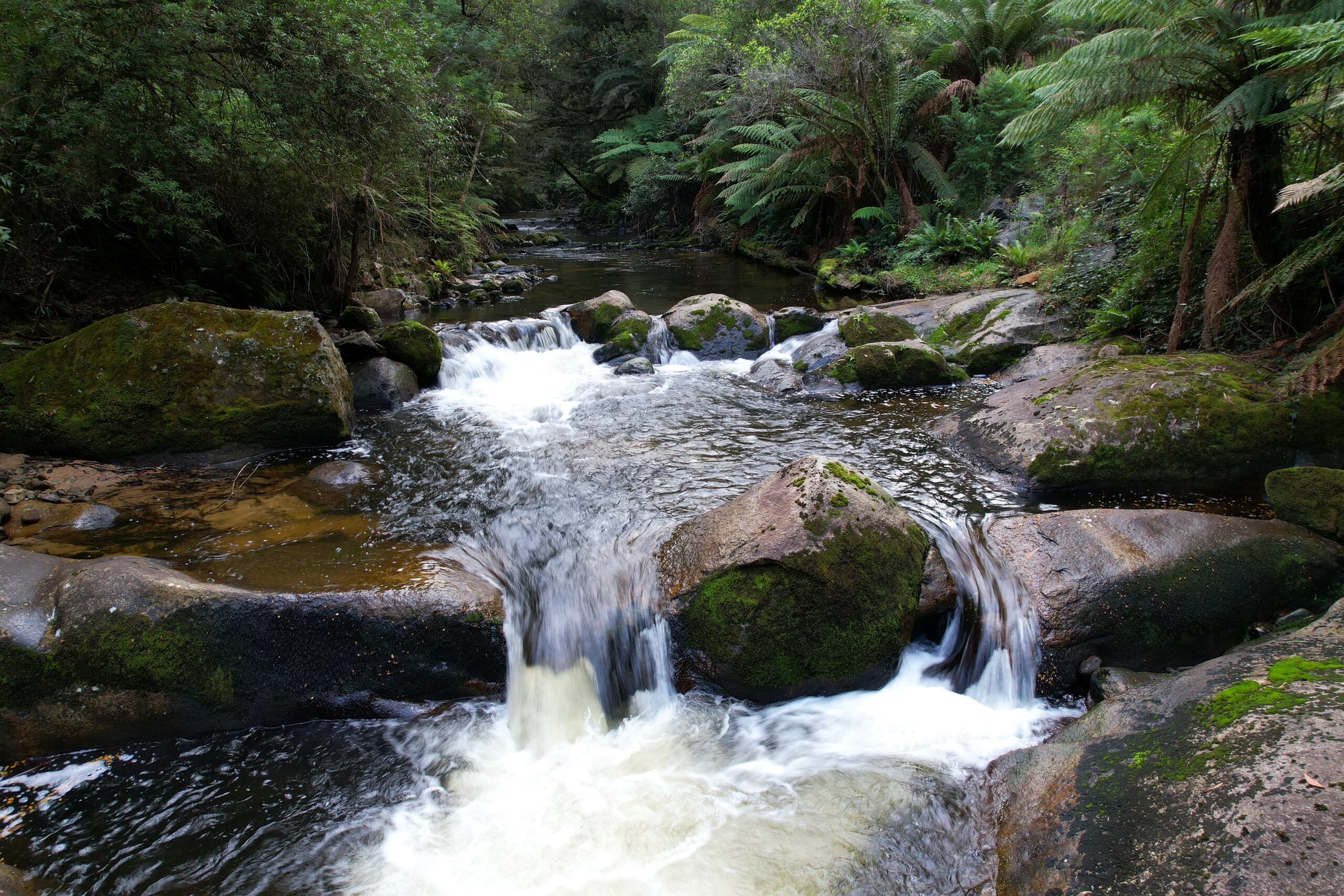
Chasing the milky way pays off for photo comp winner
A spectacular night sky photo titled ‘Where Two Rivers Meet’ has been awarded first prize in West Gippsland Catchment Management Authority’s (CMA) photo competition.
The celestial image was chosen for its unique perspective of West Gippsland’s rivers. Taken by Sale resident Iryna MacMillan, it perfectly reflects the theme of rivers being much more than just water.
“I was chasing the Milky Way at Swing Bridge. In the image we can see the Milky Way, the planet Venus and a pink Aurora on the left. It was a beautiful night and very inspiring,” said Iryna who moved to Australia from Ukraine over 20 years ago.
With her flair for photography, it’s the second time Iryna has entered the competition coming runner up in 2024.
“I’m an amateur nature photographer. I love nature, but mostly I love the Night Sky…. I love taking night photos of our Milky Way Galaxy and unpredictable Aurora too. I call this my Night Sky Therapy…. because I’m alone with all these stars around me…. But when I get reflection of the stars in a river it’s an extra bonus,” Iryna said.
Colin Cook took out second prize for his vibrant image of Lower Latrobe Wetlands shot during a memorable visit to Heart Morass with the Latrobe Valley Camera Club.
“The Heart Morass project is a shining example of how human intervention can restore the natural balance of ecosystems. Located in the Gippsland region of Victoria, Australia, this ambitious initiative has successfully transformed degraded farmland back into its original wetland state, benefiting both the environment and local communities,” said Colin.
Spoilt for choice, the judges also nominated two special mentions to Paula Walland for her photo titled ‘Fishing’ and Kylie Jackson for her image ‘Durt’Yowan’.
“More than just water, the Latrobe River not only provides recreational value in the form of fishing and peaceful moments in nature but also serves as a powerful reminder of the vital connection between water, food and life. With fishing, relaxation and lessons learned, what more could you want from water? said Paula.
Kylie’s image ‘Durt’Yowan’ captures the rich, ancient beauty of rivers at their headwaters where they start their journeys.
“This photo symbolises life, representing growth, renewal, and nourishment. It conveys peace and tranquillity,” said Kylie of her image. “I remember my Dad handing me his camera at Marlo with a 24 exposure film and l used the entire film on taking photos of the pelicans. Landscape & nature photography are my passion and I try and take a different perspective with my photography and keep the photos original as possible to show the capture’s natural beauty.”
Judges were impressed with the number and quality of images submitted in this year’s competition.
“It was very difficult to choose the winners – and we thank everyone for taking the time to submit and to share their reasons why West Gippsland’s waterways are much more than water to them,” said CEO of West Gippsland CMA, Martin Fuller.
“The photos showcase the many ways, places and times that people connect, respect and enjoy the region’s rivers and wetlands.”
Images will form part of the West Gippsland CMA’s annual Seasonal Watering Proposal document to be submitted to the Victorian Environmental Water Holder. Once approved, the proposal is used to plan the year’s environmental water deliveries to promote and support healthy waterways and ecosystems along the:
- Durt’Yowan (Latrobe River) – including the Lower Latrobe Wetlands such as Dowd Morass, Heart Morass and Sale Common
- Wirn wirndook Yeerung (Macalister River)
- Carran Carran (Thomson River) – including Heyfield Wetlands.
“We are proud to be caring for catchments and delivering water into the environment to keep rivers and wetlands flowing and healthy for nature, wildlife and our highly valued community,” Martin concluded.
The annual competition will be held again in early 2026.
West Gippsland CMA is responsible for over 40,000 kilometres of designated waterways across the region and delivers programs for healthy and resilient catchments. All these waterways flow to the Victorian coast, discharging through the Gippsland Lakes, or directly into Bass Strait and the Southern Ocean.
Become a river lover
Find out more about the work we do and sign up to our e-water newsletter for updates

Casting call for Gippsland producers to star in sustainable irrigation program
It’s not quite Farmer Wants a Wife, but it’s just as important! West Gippsland Catchment Management is on the hunt for irrigators to join us in ensuring Gippsland irrigation practices are world class.
The Lake Wellington Irrigator Reference Group meets four times a year to have robust conversations around irrigation and explore opportunities to improve water use efficiencies and deliver cutting edge change on the ground.
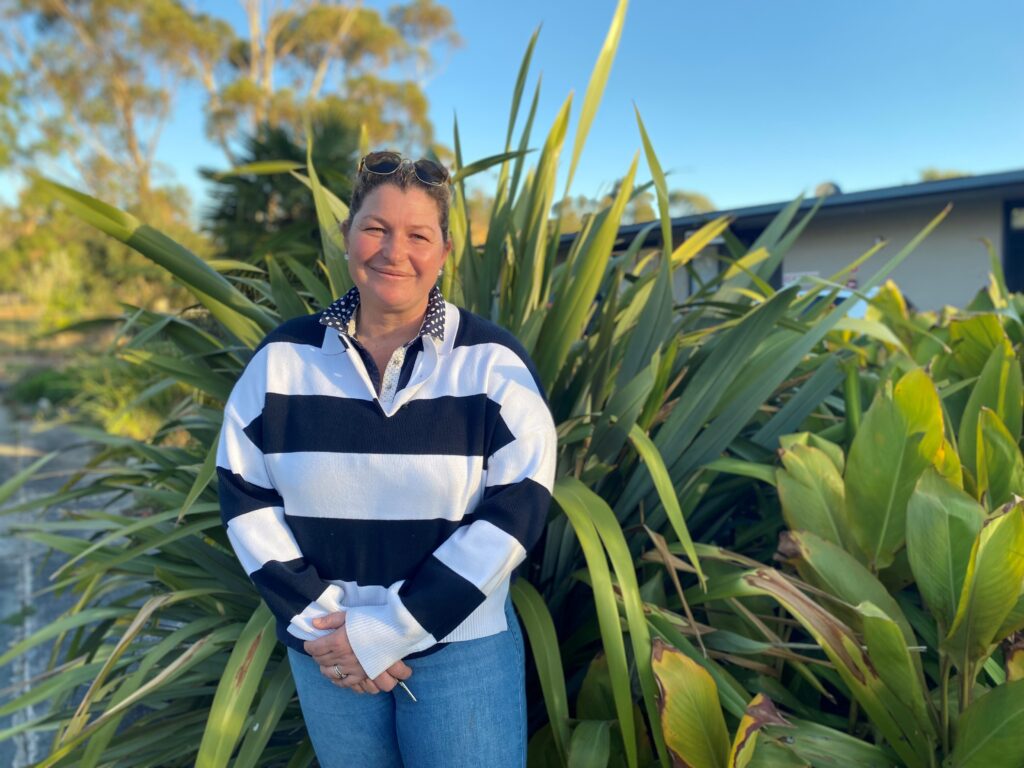
“The current group has left a fantastic legacy for the region and now it’s time to welcome some new voices to the conversation,” said Sustainable Irrigation Project Officer with the CMA, Bonnie Dawson.
Group members play a leading role in supporting the Sustainable Irrigation Program in Gippsland. For the past 25 years, the successful program has worked to reduce the environmental impact of irrigation and increase efficiencies and productivity for busy farmers. As the program expands beyond the Macalister Irrigation District for the first time, members will help deliver the latest round of extension and incentive programs in their local community.
“With more farmers set to benefit from our activities, we’re keen for irrigators across the catchment to get involved, bring their industry expertise to the table and help us drive the program into the future. Farmers along the Latrobe River, producers in Thorpdale and surrounds and all irrigators across the Lake Wellington Catchment are encouraged to apply,” said Bonnie.
Supported by staff from both the CMA and Agriculture Victoria, members will be remunerated for their valued time and input.
Current member Rod Warren said being involved in the group has helped him make decisions about upgrading infrastructure on his dairy farm in Winnindoo. “Being part of the reference group has been a rewarding experience. A highlight for me was being involved in the irrigation demonstration trials, which really got people thinking about ways they can improve efficiencies on their own farm. I would strongly encourage anyone thinking about joining the reference group to give it a go,” said Rod.
Agronomist and fellow member Liz Semmens agrees. “It’s been an amazing experience to be able to participate in the group. I’ve enjoyed seeing the younger members come through and challenge the ‘norms’ with more AgTech and progress to stay up to date with world best practice. There has also been significant growth toward collaboration between agencies and the opportunity to get a seat at the table is one I am grateful for.”
For more information, contact Bonnie Dawson from the CMA for an initial conversation at bonnied@wgcma.vic.gov.au or call 0448 037 461.
Expressions of interest close on Friday, 6 June 2025.
This program is a part of the Department of Energy, Environment and Climate Action’s Sustainable Irrigation Program (SIP), implemented in Gippsland by Agriculture Victoria and the WGCMA.
West Gippsland CMA is responsible for over 40,000 kilometres of designated waterways across the region and delivers programs for healthy and resilient catchments. All these waterways flow to the Victorian coast, discharging through the Gippsland Lakes, or directly into Bass Strait and the Southern Ocean.
Become a river lover
Find out more about the work we do and sign up to our e-news for updates.
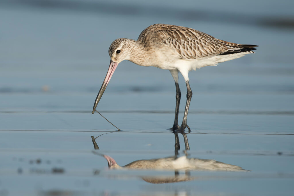
From Corner Inlet to Alaska in nine days: the amazing feats of migratory birds
A tiny bird the size and weight of a matchbox that flies thousands of kilometres from the Siberian tundra is one of the amazing stories of Corner Inlet’s migratory birds that West Gippsland Catchment Management Authority (CMA) is celebrating this World Migratory Bird Day.
Corner Inlet’s migratory birds are busy preparing for their annual long haul flight to summer breeding grounds in north-east Asia and Siberia. They are preening their feathers and feeding intensively to have enough fuel for the epic journey.
Migratory Bird Day is on Saturday 10 May. The theme of Shared Spaces aims to raise awareness of the many challenges migratory birds face and how crucial it is to work together as a community to provide safe havens for these remarkable world travellers.
“Communities working together to enhance and protect Corner Inlet Ramsar site and the migratory birds that call it home is something we have been doing for decades,” said Tanya Cowell, Waterways Project Officer for West Gippsland CMA.
“Our latest project focuses on monitoring and understanding the inlet’s migratory bird populations.”
Summer monitoring by BirdLife Australia staff and volunteers counted just over 27,000 shore and water birds including 9,631 Bar-tailed Godwits and 9,439 Red-necked Stints – two birds with incredible stories.
Red necked stints are the smallest of Australia’s migratory birds, weighing just 30 grams. Despite their size, their annual 15,000 kilometre migration is a mighty effort and in their lifetime of about 20 years they travel further than the distance between the Earth and the Moon!
Bar-tailed Godwits are also remarkable with godwits making their 11,000 kilometre journey to Alaska non-stop in nine days!
There are 16 species of international migratory shorebirds that are regularly supported by the Corner Inlet Ramsar site. Many travel to north east Asia and Alaska along what is known as the East Asian Australasian Flyway with habitat destruction being one of their biggest threats.
Corner Inlet became an internationally recognised wetland through the Ramsar convention in 1982. The inlet’s extensive intertidal mudflats provide food for migratory species.
“Rewards of a consistent and sustained effort to protect and enhance Corner Inlet by the CMA, Landcare, Greening Australia, GLaWAC Traditional Owners and partners Parks Victoria, Trust for Nature and BirdLife Australia are definitely paying off,” said Tanya.
“Ongoing monitoring is crucial to understanding the bird populations and threats they face. This can then guide effective management efforts and assist in community education and how special the inlet is and how lucky we are that these birds return each year.”
As a community it is important to recognise and celebrate these amazing birds and how we are working together to protect the incredibly unique habitat that supports these special species,” Tanya said.
“The Corner Inlet Ramsar Site Coordination project is supported by the Victorian Government.”
West Gippsland CMA is responsible for over 40,000 kilometres of designated waterways across the region and delivers programs for healthy and resilient catchments. All these waterways flow to the Victorian coast, discharging through the Gippsland Lakes, or directly into Bass Strait and the Southern Ocean.
Become a river lover
Find out more about the work we do and sign up to our e-news for updates.
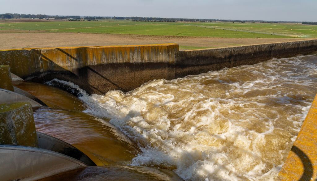
Reallocated water to flow across Gippsland
More water is set to flow in West Gippsland’s rivers with Minister for Water Gayle Tierney announcing an allocation of 16 gigalitres of water for the environment, Traditional Owners and farming.
This water (that’s 16 billion litres or 6,400 Olympic-sized pools was previously set aside for power generation, but is currently unused and has now been reallocated to be equally shared between Traditional Owners, the environment and agriculture.
“I’m so pleased to announce this reallocation of water which is a win-win-win for Gippsland. This change ensures more water supply within Gippsland to support the environment, farming, and Traditional Owners,” said Minister for Water Gayle Tierney.
Additional water for environment flows will improve the health of Durt’Yowan (Latrobe River) as well as the Gippsland Lakes system downstream.
“This allocation of water for the environment will play an important role in improving the health of one of Gippsland’s iconic rivers with additional benefits for communities and the Gippsland Lakes,” said West Gippsland CMA Board Chair Mikaela Power.
Gunaikurnai Land and Waters Aboriginal Corporation (GLaWAC) will have access to additional water for self-determined cultural uses.
“Water is more than a resource; it’s a pathway to healing and a stronger future for our people. This allocation recognises the Gunaikurnai People’s enduring connection to Country, and our right to lead how water is respectfully managed and shared,” said GLaWAC Chair, Troy McDonald.
Southern Rural Water will make additional water available to farmers.
Southern Rural Water Managing Director Cameron FitzGerald said the organisation would effectively consult with its customers from June.
“Our focus is to ensure that all farmers will have fair access to this water,” Mr FitzGerald said. “We will be consulting over the coming months to ensure that the water can be provided in a way that meets their aspirations to ensure a thriving agriculture sector.”
“Having more water available for farming benefits everyone, from irrigators looking to improve their water security or expand their operations to farmers looking to set up in the region,” said irrigator Angus Zilm.
This water allocation, known as the Latrobe 3-4 Bench Bulk Water Entitlement, was originally allocated back in 1996 for coal fired power generation.
The decision to reallocate 16 of the total 25 gigalitre water entitlement was made through the Central and Gippsland Region Sustainable Water Strategy. The remaining nine gigalitres will be retained by government to provide continued flexibility to respond to emerging needs in Gippsland.
West Gippsland CMA is working with Traditional Owners, government, community groups and partner organisations to continue the long process of restoring Durt’Yowan (Latrobe River) from a working river to a river that works again. Read more and keep up to date.
West Gippsland CMA is responsible for over 40,000 kilometres of designated waterways across the region and delivers programs for healthy and resilient catchments. All these waterways flow to the Victorian coast, discharging through the Gippsland Lakes, or directly into Bass Strait and the Southern Ocean.
Become a river lover
Find out more about the work we do and sign up to our e-news for updates.
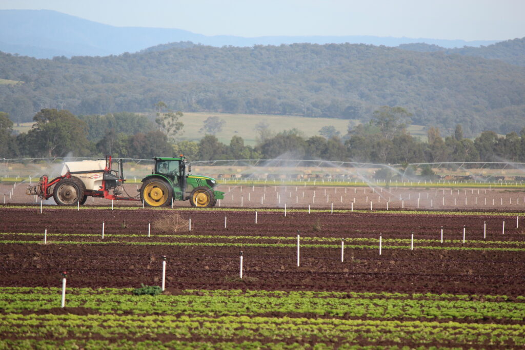
Popular Irrigation Incentive program set to benefit even more Gippsland farmers
West Gippsland Catchment Management Authority (the CMA) and Agriculture Victoria (Ag Vic) are pleased to open a new round of farm plan incentives, and for the first time, farmers in Warragul, Thorpdale, Noojee and Perry Bridge and across the entire Lake Wellington Catchment are eligible to apply.
Up to $10,000 per farm is available through the Lake Wellington Irrigation Efficiency Incentive Program to help with the cost of a professionally designed irrigation plan.
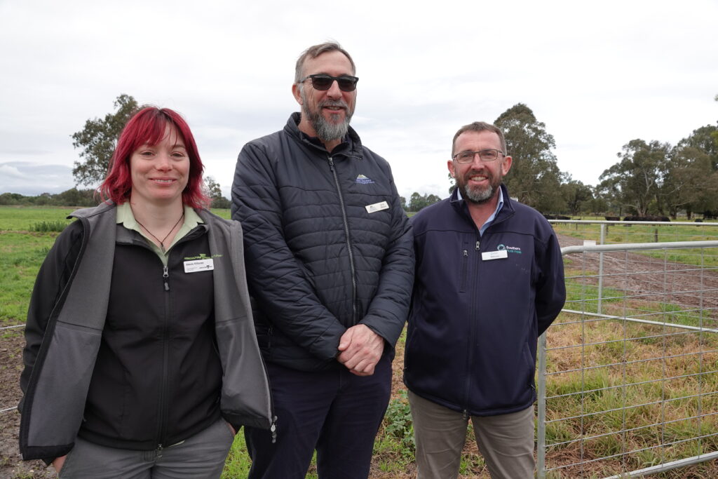
“A farm plan sets down on paper the irrigation design for an individual property,” said Alexis Killoran Senior Irrigation Extension Officer from Agriculture Victoria. “This can be a simple irrigation system, right up to a detailed survey and design with integrated farm infrastructure. “The final farm plan provides a comprehensive document to refer to whenever the farm business is ready to implement the planned design.”
“Designing an irrigation farm plan is the first essential step for any irrigation renovation,” said Brad Missen, Irrigation Development Coordinator at the CMA.
“Through the Irrigation Incentives Program, the CMA and Agriculture Victoria will work with you to develop a plan and design that’s tailored to your property and farm business.”
“As part of the farm planning process, the business goals and values, irrigation design, water use efficiency, staged development, and any environmental or statutory requirements are considered and planned for,” Brad explained.
Boisdale beef farmer Nicky Reeves recommends the program: “I had lots of support from the Ag Vic team through the farm planning process. They provided different points of view, and together we found ways to solve the irrigation problems on farm.
With their help I felt comfortable interacting with statutory authorities to make sure everything was compliant and approvable, and the rules and regulations were explained so that they made sense, and I understood why they were necessary.”
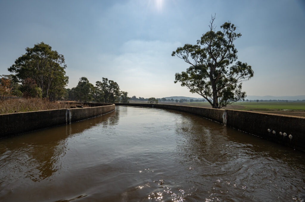
The Irrigation Efficiency Incentives Program has been running in the Macalister Irrigation District for 25 years with irrigators helping to retain 46 gigalitres of nutrient rich water, carrying an estimated 23 tonnes of phosphorus, on-farm every year.
“That’s a huge load of phosphorus being kept out of the waterways and the Gippsland Lakes and wetlands and it’s thanks to those farmers who put their hands up to get involved in our sustainable irrigation programs that we’ve been able to see these great results,” said Brad.
We want to continue supporting as many irrigators as possible which is why we’re excited to expand the program outside the Macalister Irrigation District,” said Brad.
“If you’ve never had an irrigation farm plan developed before or it’s been over ten years since you’ve made any irrigation improvements, now is the time to do it.”
Applications are now open with funding allocated on a first-come, first served basis, you can call the CMA for more information on 1300 094 262.
The Lake Wellington Irrigation Efficiency Incentive Program is run by West Gippsland CMA and Agriculture Victoria and funded by the Victorian Government’s Sustainable Irrigation Program.