Celebrating sustainable farming
Celebrating a 25-year pivot towards sustainable farming future This year, West Gippsland Catchment Management Authority (CMA) is celebrating the 25th…
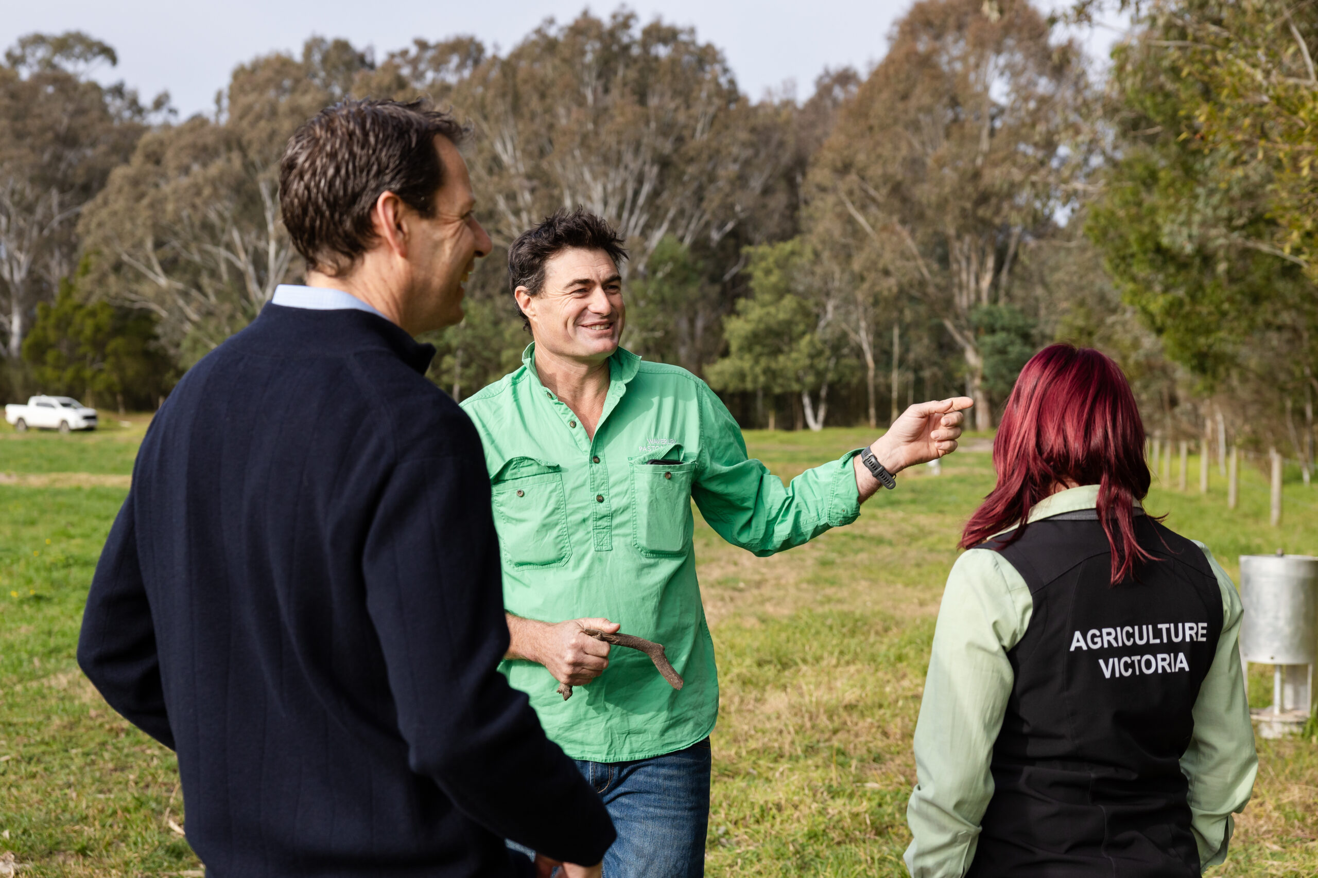
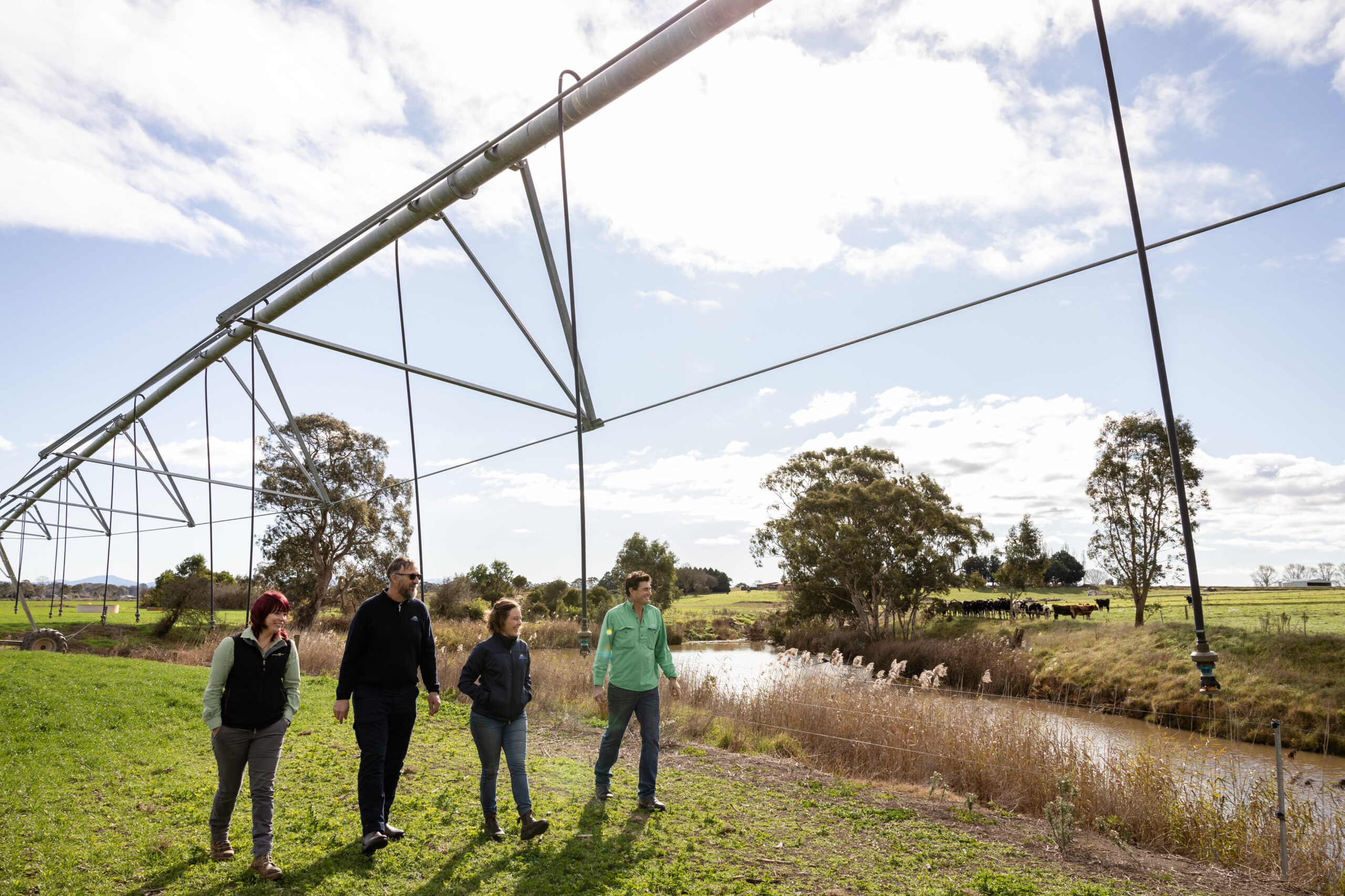
Together with Agriculture Victoria, we’re working with the irrigation community to keep water and nutrients on farm and out of the local waterways, including the Gippsland Lakes.
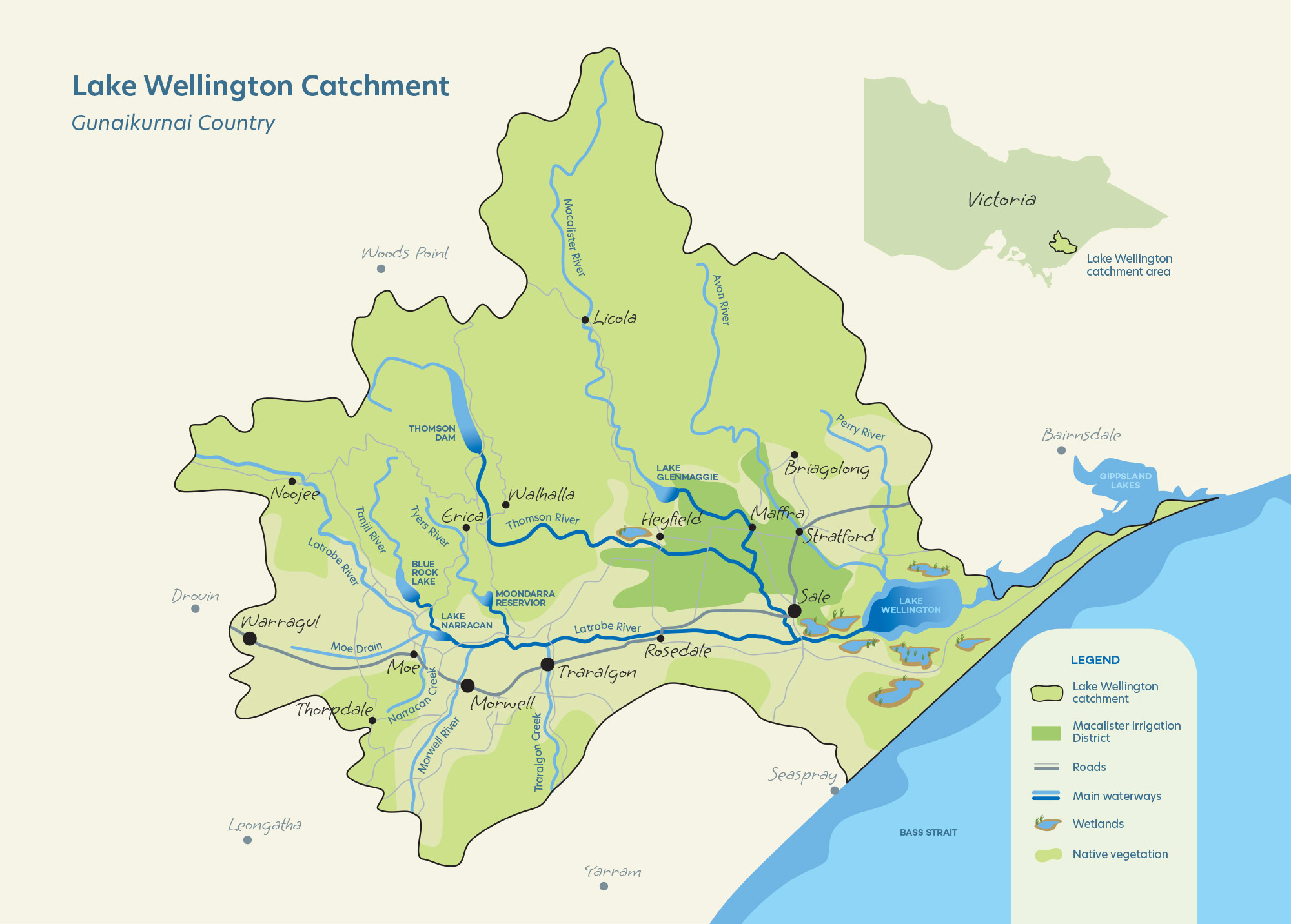
The Sustainable Irrigation Program provides funding and support for irrigators in the Macalister Irrigation District and across the broader Lake Wellington Catchment.
Activities focus on improving water use efficiencies, adopting best management practices and keeping phosphorus on farms where it supports soil health and pasture growth. By improving how irrigation is designed and managed, farms also reduce the impact from salinity and water-logged paddocks that can reduce farm productivity.
The program is underpinned by the Lake Wellington Land and Water Management Plan, a long-term strategy that outlines how irrigators, industry and government will work together to achieve a highly productive and sustainable irrigation community that values and protects its natural and cultural assets.
You can explore the Lake Wellington Catchment map and the video we created to celebrate 25 years of sustainable irrigation “How 25 years of sustainable irrigation has transformed central Gippsland” can also be viewed from the links below.
Further partnerships with agency and industry bodies is coordinated through the Lake Wellington Sustainable Irrigation Group. The Sustainable Irrigation Group is responsible for overseeing the implementation of the Lake Wellington Land and Water Management Plan and its integration with other strategies and activities as appropriate (e.g. irrigation modernisation programs, the Gippsland Sustainable Water Strategy, research collaborations, etc).
Membership of the Lake Wellington Sustainable Irrigation Group includes:
The Sustainable Irrigation Program is a part of the Department of Energy, Environment and Climate Action Sustainable Irrigation Program, implemented in Gippsland by Agriculture Victoria and the West Gippsland CMA.
Celebrating a 25-year pivot towards sustainable farming future This year, West Gippsland Catchment Management Authority (CMA) is celebrating the 25th…
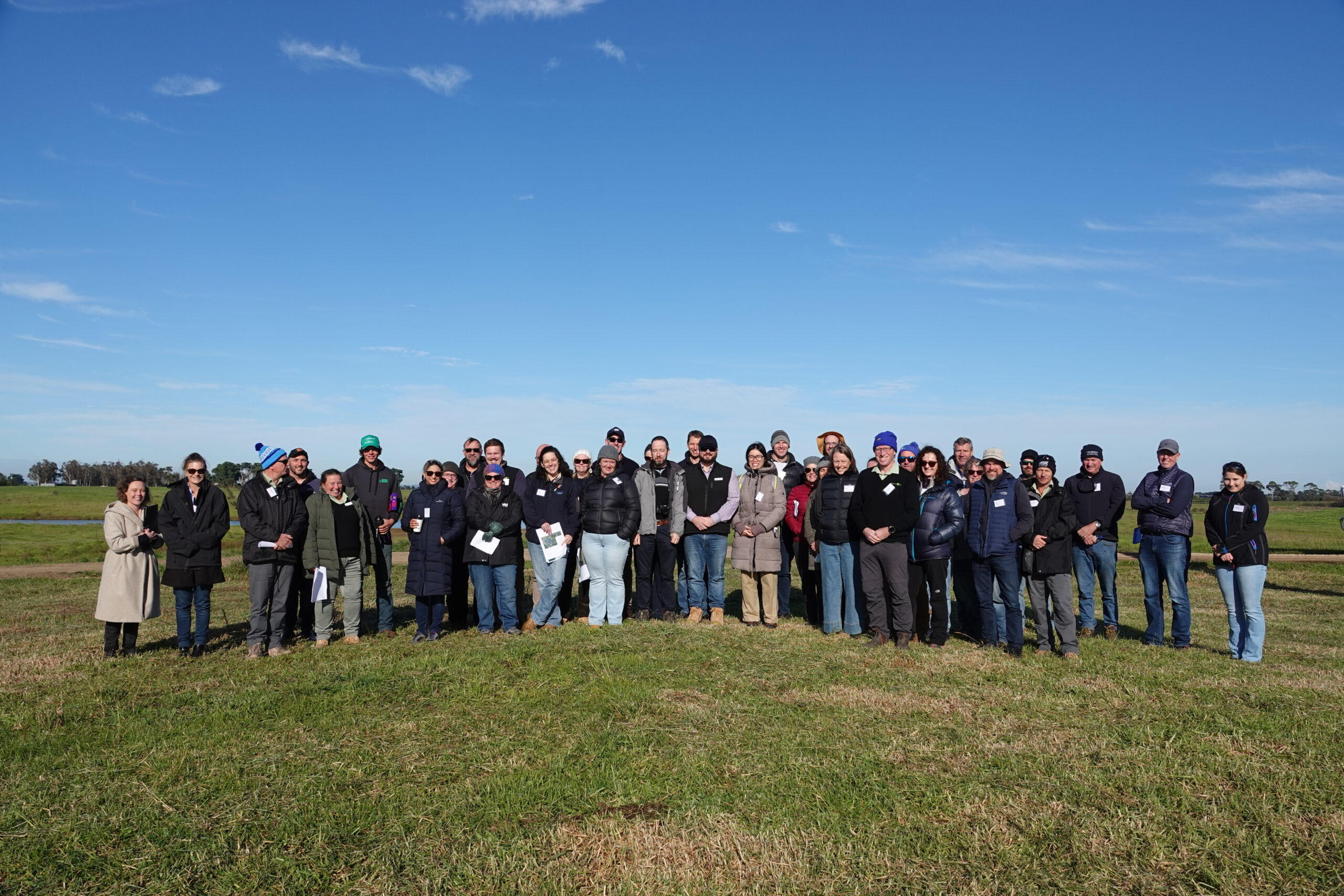

We are on the hunt for irrigators to join us in ensuring Gippsland irrigation practices are world class.
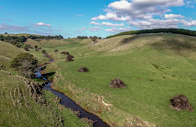
Platypus numbers are falling because they’re losing their habitat. Polluted waterways, urban development and impacts of dams and droughts on flowing water are all contributing to a decline in platy numbers.
To survive, platys need stable banks for burrowing, plenty of waterbugs to eat, healthy streamside vegetation, plenty of in-stream woody habitat and reliable flow through the creek or stream they live in.
We love platys and want to help them survive and thrive in waterways once again. So, we’re working with partners to restore high-quality habitat at three key locations along Traralgon Creek on Gunaikurnai Country, where Platypus are known to live.
The work involves:
Improving habitat and restoring these sections of the creek will also benefit other wildlife, including the vulnerable Australian Grayling fish and the Australasian Bittern, a critically endangered waterbird.
The Latrobe Valley community will be able to enjoy the newly greened spaces as a place to connect with nature and, if they’re lucky, spot a shy Platypus.
This Traralgon Creek project is one of 14 waterway restoration projects happening across the state under the Platy Patch Project.
The Platy Patch project is jointly funded by the Australian Government’s Natural Heritage Trust under the Urban Rivers and Catchments Program, the Victorian Government, and Melbourne Water, under the guidance of the Arthur Rylah Institute (ARI), with the support of One Tree Planted, City of Ballarat, Coliban Water, Zoos Victoria, and catchment management authorities.
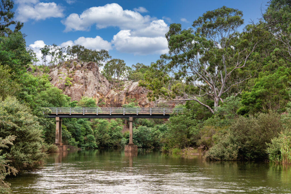
The Mid-Thomson River, known as Carran Carran by Gunaikurnai Traditional Owners, is a flagship river in West Gippsland.
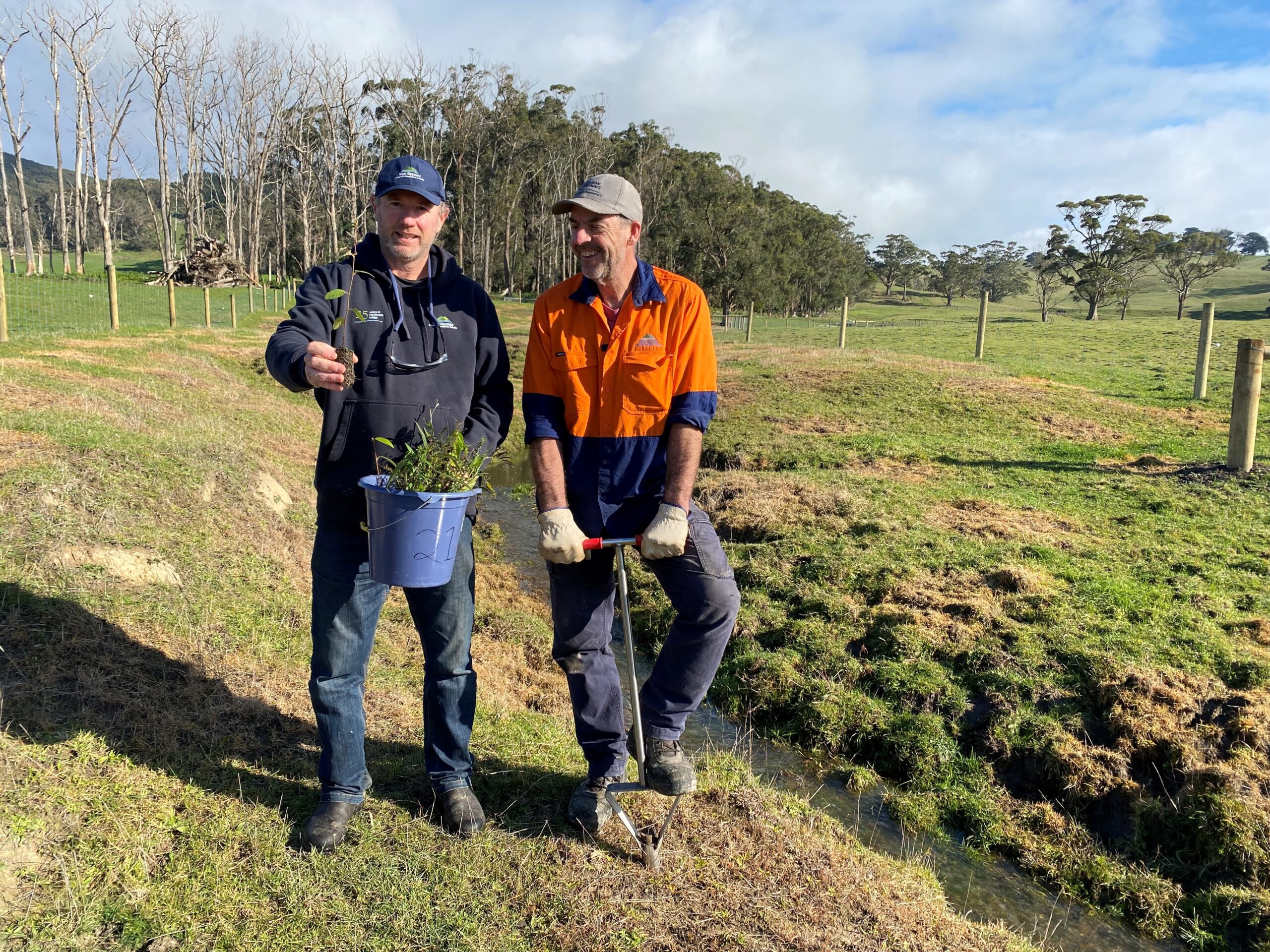
This project focuses on the Carran Carran (Thomson River) and Rainbow Creek between the Cowwarr Weir and the township of Heyfield. It addresses the risk of avulsion (where a waterway creates a new path in times of flood) across the agricultural land between Carran Carran (Thomson River) and Rainbow Creek. We are working in partnership with landholders to remove willows, treat avulsion ‘hotspots’, plant native vegetation and fence off waterways.
Works are done in alignment with the Thomson and Rainbow Management Plan that was developed along with community and partners to achieve our shared hopes for the river’s future – to manage the balance of its flow and reduce the risk of ‘avulsions’ developing (where a waterway creates a new path in times of flood).
We are currently in the ‘taking action’ phase of this long term project to build on the success of the past eight years.
We are working with landholders and partners to:
The Mid-Thomson Flagship project is supported by the Victorian Government through the Victorian Waterways Management Program.

Spring in West Gippsland is full of life and native fish are on the move, to make the most of this our Environmental Water team have been hard at work planning how we can best care for our rivers during this important time.
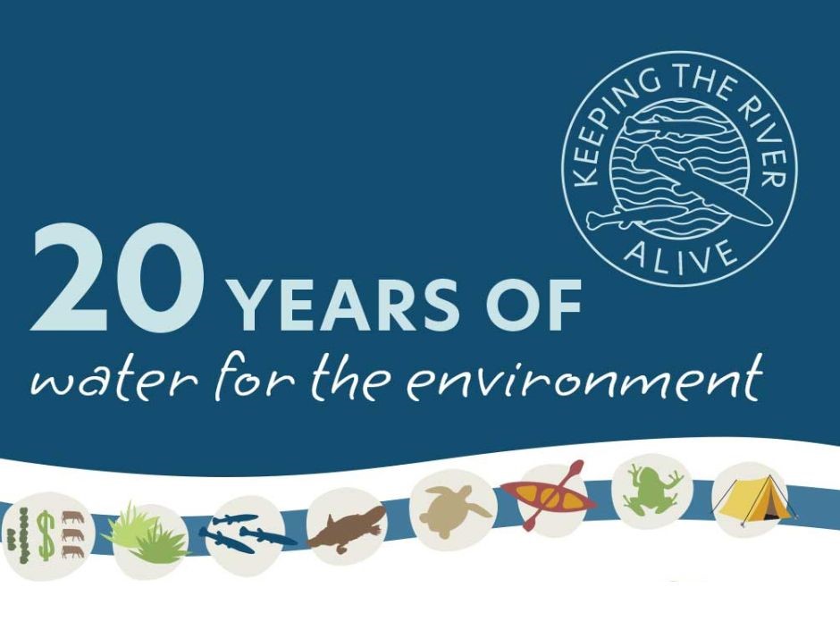
West Gippsland Catchment Management Authority is celebrating 20 years of delivering water to keep the much-loved Thomson River (Carran Carran) alive, flowing and healthy.
Get set up for a carbon farming future with free training for Gippsland farmers.
The Carbon Farming Outreach Program provides free training for farmers to better understand their emissions and learn the benefits of carbon farming so they can take advantage of opportunities as we move towards a low-carbon future.
Carbon farming refers to managing land or agriculture to maximise the amount of carbon stored and minimise greenhouse gas emissions. For landholders, carbon farming can deliver benefits such as increasing productivity, biodiversity, resilience to drought and can also provide additional income sources.
Understanding how to make the most of carbon farming depends on the type of farm, the business needs and the landscape it operates in.
During September 2025 and March 2026, West Gippsland CMA will deliver a series of training sessions across the Gippsland region in partnership with local Landcare groups.
This free training covers:
Workshops will be advertised on our website and social media channels.
You can also find resources about managing farm emissions and state-wide events on the Landcare Victoria website.
The Victorian Carbon Farming Outreach Program is delivered with funding support from the Commonwealth of Australia through the Department of Climate Change, Energy, the Environment and Water under the National Carbon Farming Outreach Program. The Program is delivered through a partnership between Agriculture Victoria, 10 Catchment Management Authorities and Landcare Victoria and other bodies.
Planting trees on farms can offer many opportunities, come along to this event and learn how to benefit your farm and the opportunities for agroforestry in livestock enterprises at this farm field day.
Carbon farming is talked about a lot right now, but what exactly is it? That’s what 35 South Gippsland farmers came to find out at the ‘Down to Earth Farm Field’ day at Malabar Farm in Tarwin Lower recently.
Join us for this farm field day to hear from experts how shelterbelts can increase farm production, improve biodiversity, reduce your carbon footprint and diversify income through agroforestry.
Corner Inlet is a precious place. It has been declared a Ramsar Site which means that it is internationally significant because it:
West Gippsland CMA are the site coordinators for the wetland and we a proud to work with partners and the community to protect these values.
Ramsar status is special and Corner Inlet is a unique asset to the environment and community.
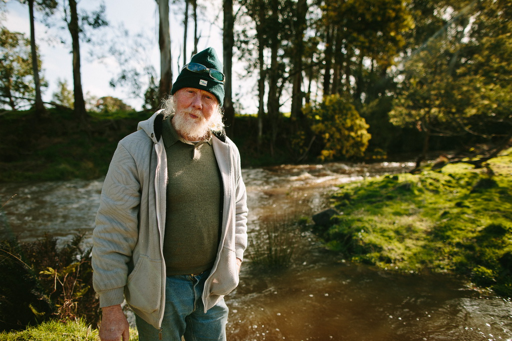
Tanya Cowell, Waterways Project Officer for West Gippsland CMA
The Corner Inlet Ramsar site coordination project is supported by the Victorian Government.

A tiny bird the size and weight of a matchbox that flies thousands of kilometres from the Siberian tundra is one of the amazing stories of Corner Inlet’s migratory birds that West Gippsland Catchment Management Authority (CMA) is celebrating this World Migratory Bird Day.
It’s all about the power and passion on this episode of the podcast as we chat with some inspiring people involved in a twenty-year partnership to restore the entire length of the Agnes River and protect the world-renowned Corner Inlet a very special milestone for all those involved.
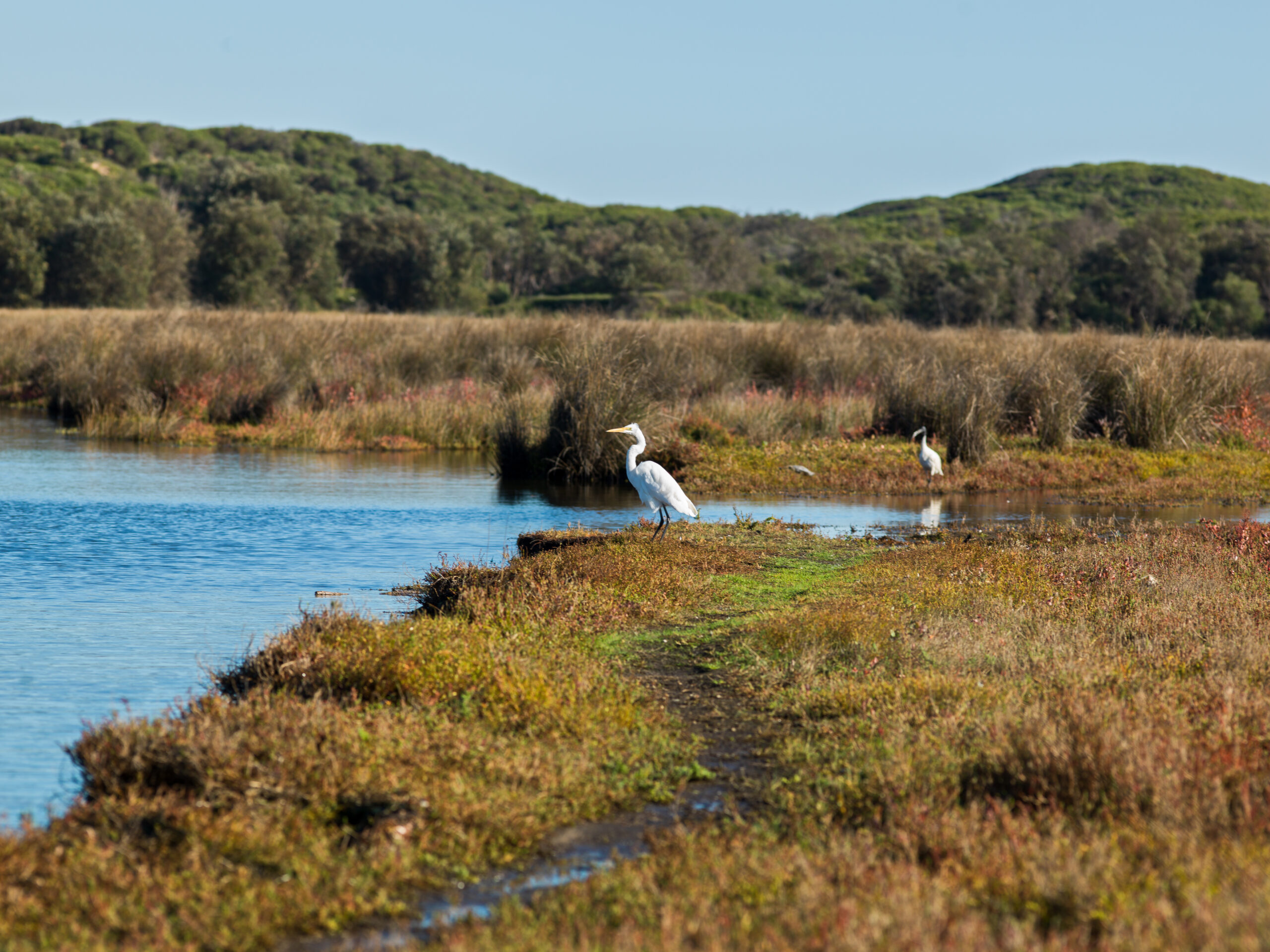
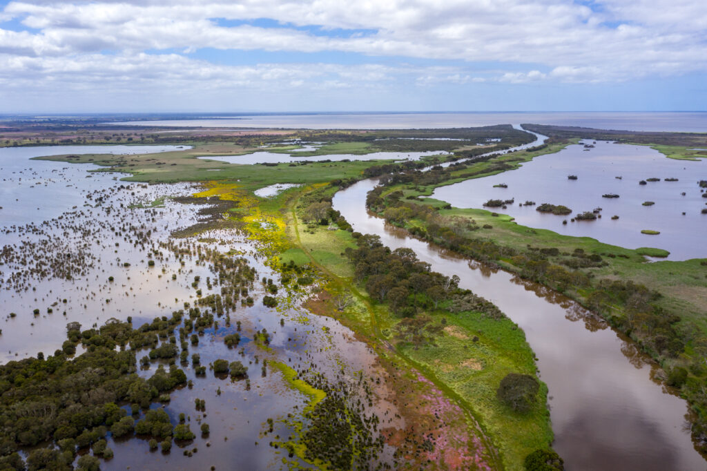
From Inverloch to Kilcunda rivers flow into Bass Strait and these areas are known as estuaries. They are precious waterways and coasts with high cultural significance and deep importance for Traditional Owners.
These estuaries open and close over time (known as Intermittently Open/Closed Estuaries) and are very important waterways that provide habitat for animals – some threatened. This includes Fairy Terns, Orange-Bellied Parrots, Hooded Plovers and important native fish such as the Australian Grayling.
Estuaries also support threatened plant communities such as temperate saltmarsh, estuarine swamp/scrub and important landscape features like a salt wedge estuary.
The Bunurong to Mullundung Coast’s Intermittently Open/Closed Estuaries and Inlets support recreational activities such as fishing, kayaking, swimming and walking and contribute to agriculture and tourism.
The Estuaries and Inlets of Bunurong to Mullundung Coasts project is supported by the Victorian Government through the Victorian Waterways Management Program.
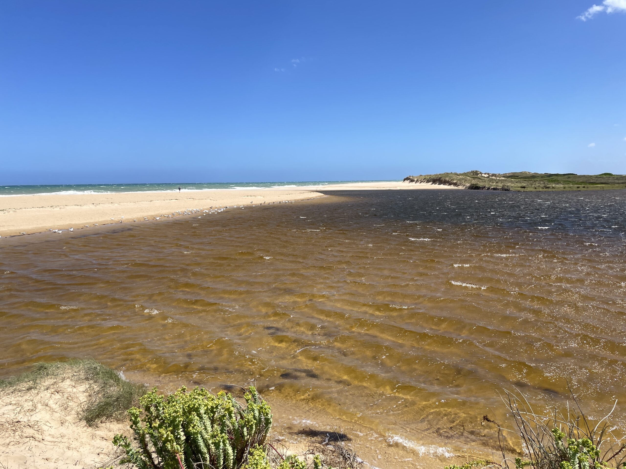
Estuaries are dynamic and often in a state of transition, this Autumn is a great example of an environmental zone that is in flux. Across West Gippsland, estuaries are super important, working hard to soften the transition as rivers meet the sea, as conditions change so do the estuaries.
The Powlett River/Kugerungmome estuary on Bunurong Country near Kilcunda is a significant and ever-changing wetland that provides essential habitat for wildlife. In late August 2024, the river mouth closed to Bass Strait naturally and West Gippsland CMA is monitoring the event.
Bourne Creek estuary entrance closed naturally to the ocean last week after large swells deposited sand across the estuary entrance. Those same swells caused water levels in the creek to rise, the estuary is scheduled to be opened on Tuesday 3 September 2024.
Through our Climate Smart Farmers project, we’re supporting Gippsland farmers with practical, on-ground activities designed to drive agricultural growth and protect and conserve natural capital and biodiversity at the same time.
Supporting farmers with the costs of fencing to protect biodiversity.
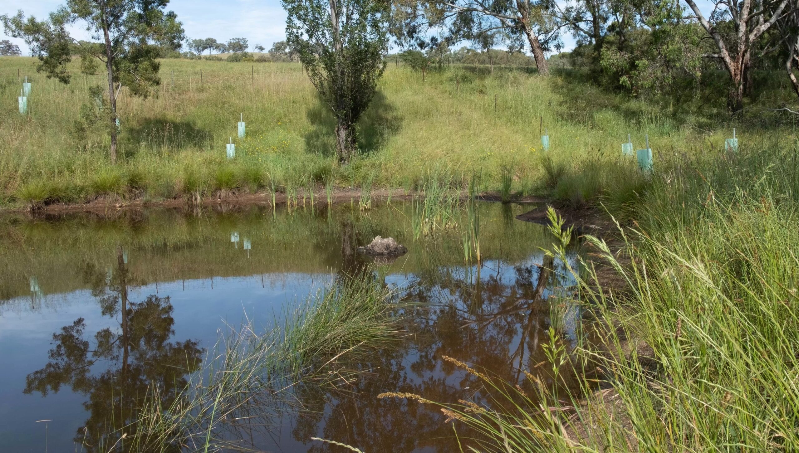
Fencing livestock out of wetlands, waterways and patches of remnant native vegetation can greatly benefit biodiversity, while also improving the management of farming operations.
Removing livestock from steep slopes and erosion sites can reduce the loss of valuable topsoil and at the same time improve habitat for native wildlife. Fencing is also the first step in creating shelterbelts for livestock, which can then serve as important corridors for native wildlife to move through the landscape.
Grant applications closed in April 2025.
Supporting up to 15 dairy farmers in the Macalister Irrigation District to make the most of dairy effluent.
This funding stream aims to help farmers increase the area of effluent distribution on their farms by providing customised advice and practical support to upgrade infrastructure and improve effluent management practices.
By maximising the use of effluent across the farm, farmers can reduce the use of synthetic fertiliser, saving money and emissions.
Grant applications closed in June 2025.
Delivered over four years (2024-2028), the $1.68m Climate Smart Farmers project is supported by the Australian Government through funding from the Natural Heritage Trust under the Climate-Smart Agriculture Program.
Join us for a field day at Wilandra Farms in Clydebank to learn about the science and benefits of enhancing farm dams.
Over 300 hectares of valuable biodiversity areas on agricultural land will be fenced to protect waterways, remnant vegetation, threatened species and livestock thanks to West Gippsland Catchment Management Authority (the CMA)’s farm fencing grants.
Dairy effluent is a valuable source of nutrients that can save you money. Learn how to make the most of it on your farm at a free workshop for dairy farmers presented by Tony Evans, founding director of Camperdown Compost.
This project was developed through a collaborative approach involving project partners and stakeholder and was built on earlier successful work to protect Corner Inlet and has improved the water quality in the Corner Inlet Ramsar site by improving riparian condition and connectivity along priority rivers flowing into the Inlet.
Corner Inlet supports large seagrass meadows, located in shallow water and intertidal (mud flats). Seagrass is a driver on marine ecology, has an important role in carbon sequestration, provides habitat and food for invertebrates and birds and is critical to support commercial and recreational fishing.
The seagrass beds of Posidonia australis are a particularly important asset as they are the only large beds of this species in Victoria.
Seagrass extent and condition are affected by a complex set of factors, which includes sediment and nutrient contributions from catchment inflows.
This project has improved conditions for seagrass to flourish by reducing nutrient and sediment inflow into Corner Inlet, by creating vegetated riparian buffers along the main waterways that flow into Corner Inlet.
The Corner Inlet flagship project is supported by the Victorian Government.
Trees grow from seeds that spring from a pod, so this National Tree Day, West Gippsland Catchment Management Authority is sowing the seed of just how important trees are for catchments with a special podcast that demonstrates the true superpower of trees.
It’s all about the power and passion on this episode of the podcast as we chat with some inspiring people involved in a twenty-year partnership to restore the entire length of the Agnes River and protect the world-renowned Corner Inlet a very special milestone for all those involved.
Last willow gone from the Agnes River West Gippsland Catchment Management Authority (CMA) is proud to have removed the last remaining stand of willow trees from the entire length of the Agnes River – a first for the organisation and a win for the environment. “Willows are a problem for rivers and removing them from…
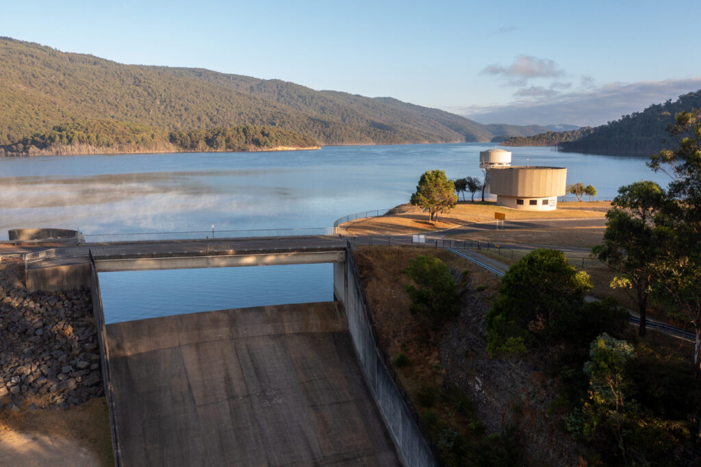
Water for the environment is water that is set aside in major reservoirs and carefully released down the river to support the health of West Gippsland’s waterways, it can also be diverted from the river into the lower Latrobe wetlands and keeps our rivers flowing and healthy.
Due to the start of the staged coal mine closures in the Latrobe Valley, as well as changes like climate change and competing demands for water, there is now a once-in-a-lifetime opportunity to restore resilience and accelerate change for the benefit of the environment and all community members.
Due to the start of the staged coal mine closures in the Latrobe Valley, as well as changes like climate change and competing demands for water, there is now a once-in-a-lifetime opportunity to restore resilience and accelerate change for the benefit of the environment and all community members.
The West Gippsland CMA has developed a strategy to turn this ‘working river’ into a river that works again. ‘Transformation of the Latrobe: Pathways for the Latrobe River System’ comprises a package of management actions to improve the condition and health of the River system. More information can be found in this fact sheet (PDF – 2MB).
The proposed program of works to improve the health of Durt’Yowan (Latrobe River) ranges from:
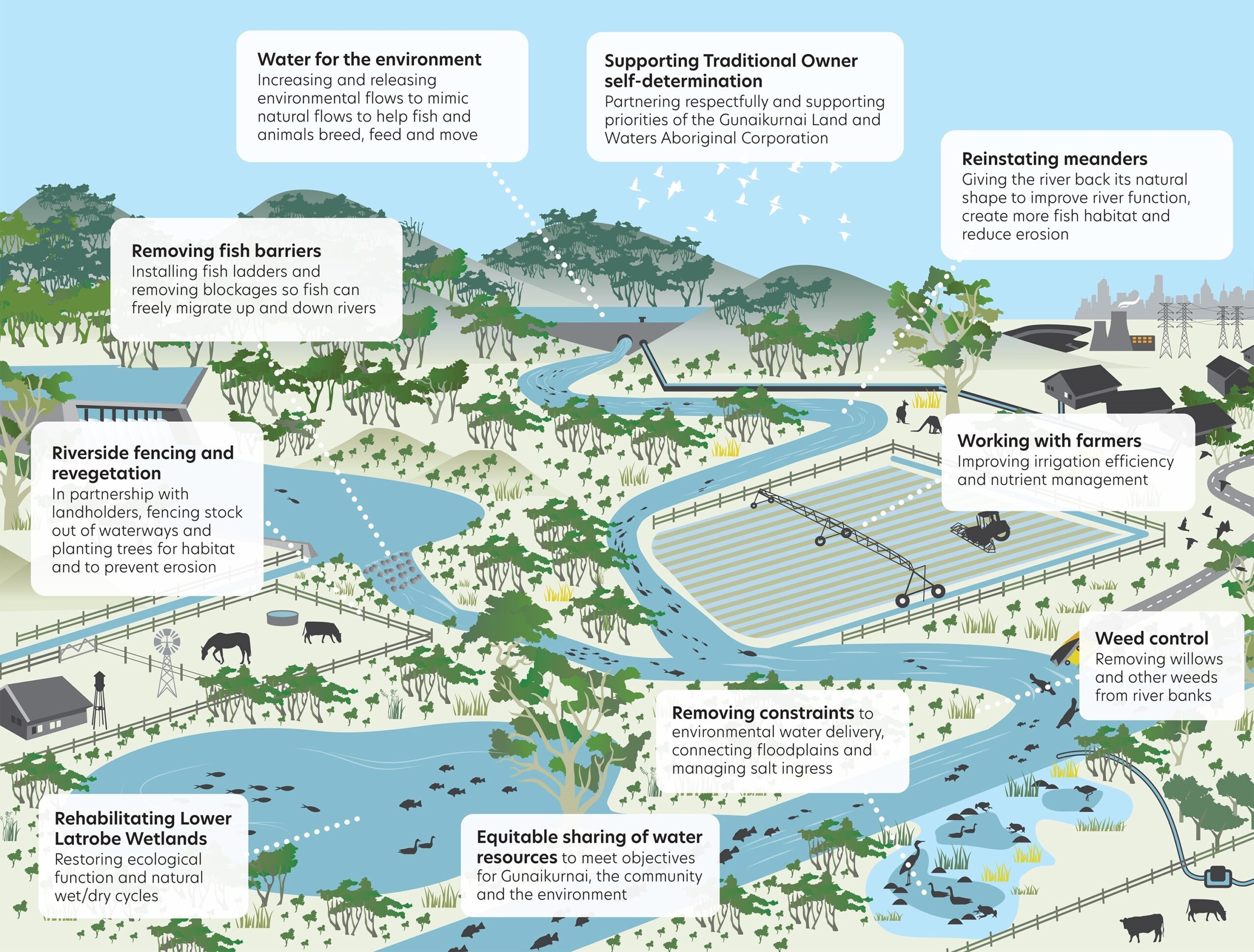
Diagram showing the proposed program of works in more detail, click to enlarge.
Now released publicly Durt’Yowan (Latrobe River): The Life Source short film, is available for you to watch and learn why Durt’Yowan has been the life source for people in Gippsland for thousands of years.
With some big changes on the horizon for the Latrobe River or Durt’Yowan as the Gunaikurnai people have called it for thousands of years, it is important to know the story behind one of Gippsland’s longest rivers.
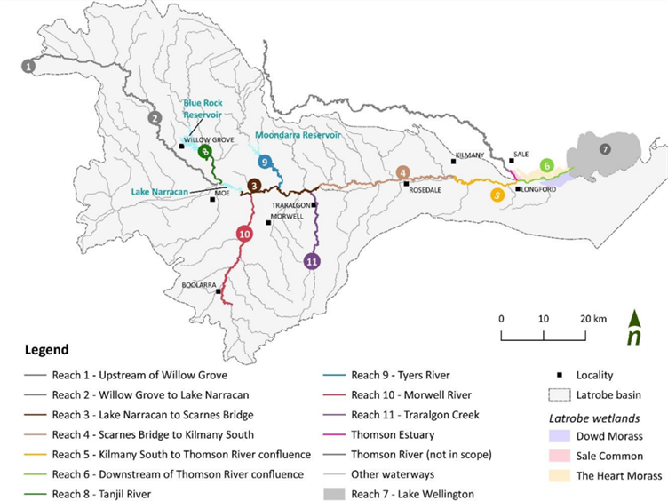
A: Durt’Yowan is the Gunaikurnai name for the Latrobe River system, it comprises the Latrobe River, its tributaries and the Lower Latrobe Wetlands, an important part of the Ramsar-listed Gippsland Lakes site.
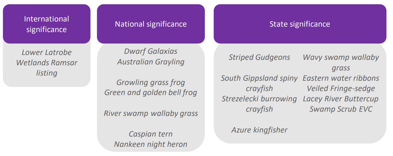
A: Durt’Yowan supports plant and animal species of high conservation significance. The Latrobe River also provides an essential source of freshwater to the Ramsar listed Gippsland Lakes site, of which the Lower Latrobe Wetlands are an important component.
In addition to the environmental values, the Latrobe system supports cultural, social, recreational and economic values. Gunaikurnai people are the traditional owners of Gippsland, and the Latrobe system. Waterways and wetlands in the region contain important ceremonial places and for thousands of years the Latrobe River provided resources such as food and medicines to the Gunaikurnai people.
Fish species such as Australian Bass, Dwarf Galaxias, Australian Grayling and Estuary Perch call the river system their home along with platypus, rakali, frogs and burrowing crayfish.
Australian Bass were released into Traralgon creek a tributary of the Latrobe River, in December 2023 in partnership with Fisheries Victoria, this ‘King of the River’ video tells the story in full.
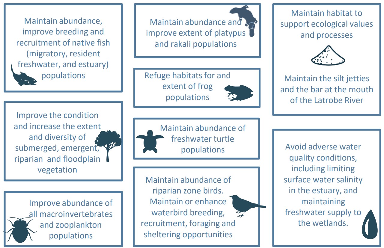
A: Environmental objectives guide the water requirement for the river system and represent the values that society seeks to improve or maintain with water for the environment.
A: The current impacts to the environment and Traditional Owner values of the Latrobe River system (including its estuary and the Ramsar listed lower Latrobe wetlands) are due to historical river course modifications, river straightening, draining of swamps/wetlands, land clearing, removal of riparian vegetation, weeds, invasive animals, constructions of large on-stream storage’s and (critically) the large volume of water removed from the river for power generation, industry, urban supply, agriculture and other purposes.
Changes to the river course have induced significant erosion problems, reduced habitat for native species, created barriers to fish migration and altered flooding patterns. Changes to the flow regime of the river degrade it’s physical and ecological health, and therefore its ability to provide environmental, social economic and cultural benefits to the community. Although some water for the environment has been allocated to the Latrobe River system (in Blue Rock Reservoir), it is not sufficient to meet the communities objectives for the river and downstream environments.
A: Competing demands for water including water for mine rehabilitation, new and emerging industries, urban growth and agricultural expansion will all place pressures on the Latrobe’s precious water resources. This is likely to be overlaid by a trend toward a climate typified by drier conditions interspersed with intense weather events. Reduced freshwater flows in the river is the greatest threat to riverine health.
Additional risks associated with mine rehabilitation, and the potential formation of large pit lakes are being investigated through processes such as the Latrobe Valley Regional Rehabilitation Strategy and the Hazelwood Mine Rehabilitation Environment Effects Study.
A: Repurposing water for mine rehabilitation would impact the ability to meet the water needs of the river system (including the estuary and the lower Latrobe wetlands) and Traditional Owners. It would entrench the significant legacy impacts of coal fired power generation in the Latrobe Valley on the Latrobe River system. This would create an enduring opportunity cost to the Victorian community to heal Country and meet community expectations to improve the health of the Latrobe River system.
In addition, it would see a change in the usage pattern of the water. Water used for power generation varies throughout the year, particularly when it comes to water stored in Blue Rock Reservoir, with a higher demand for water in the warmer months. Mine rehabilitation would see a consistent extraction of water throughout the year changing the flow regime, or pattern of flows, the river has seen for the last 50-60 years.
There are also impacts to the river’s health associated with the infrastructure built to harvest and supply river water for power generation (i.e. dams and other in-stream structures) including barriers to the movement of fish and sediment down the river.
A: The plants and animals that live in rivers rely on flows that naturally fluctuate over time according to patterns in climate and weather. This includes floods and low flows, and everything in between. Rivers need floods to remain healthy.
Floods are also vital for the health of salty environments, including estuaries and the ocean. The importance of moderate to large floods for Lake Wellington and its fringing wetlands cannot be overstated. Floods are responsible for flushing of salts through the system and providing important ecological cues for plants and animals. Plans to harvest floods to assist with rehabilitation of the Latrobe Valley coal mine voids should be carefully considered in this context.
A: The majority of towns and cities along the Latrobe River were settled at a time when floods were a regular occurrence. This meant that the towns and cities were built on higher ground to avoid most of the impacts of flooding.
Now, any development on or around the floodplain is required to go through a planning permit application process which considers the likelihood of floods impacts to the site as well as the implications of the development of neighbouring and downstream properties. Through this process, specific design elements are put on the development (eg. minimum ground floor level heights for a building) to reduce or remove the impacts of floods.
It is unlikely that ‘trimming’ floods will provide any meaningful mitigation benefit for downstream communities or landholders.
A: The West Gippsland CMA are passionate about river health. The CMA has a 25-year legacy of working with the community to improve the health of our waterways and wetlands. The CMA will be continuing in its efforts to help landholders and the community protect and revegetate riparian habitat, reinstatement natural river flow paths, remove barriers to fish passage, implement weed control and importantly secure more water for the environment.
We also recognise that the transition process in the Latrobe Valley provides a once-in-a-lifetime opportunity to accelerate these river health initiatives and build resilience into the river system to give it the best chance of surviving future challenges. The West Gippsland CMA has developed a strategy to turn this ‘working river’ into a river that works again. ‘Transformation of the Latrobe: Pathways for the Latrobe River System’ comprises a package of management actions to improve the condition and health of the River system.
A: We encourage all community members to be curious, ask questions and get involved in the important discussions about the future of the Latrobe Valley and the river system.
If you wish to be informed of future opportunities via the CMA please sign up using this form.
To stay up to date with news and events relating to Durt’Yowan (Latrobe River) submit the form below and we will keep in touch via email.
The following publications are all available for download.

More water is set to flow in West Gippsland’s rivers with Minister for Water Gayle Tierney announcing an allocation of 16 gigalitres of water for the environment, Traditional Owners and farming.
16 Hotham Street Traralgon
Victoria 3844 Australia
1300 094 262
(03) 5175 7800
Office hours:
8:30am - 3pm
Monday - Friday

We acknowledge and pay our respects to the Traditional Owners of the region, the Gunaikurnai, the Bunurong, the Boonwurrung and the Wurundjeri peoples, their rich culture and spiritual connection to Country.
We also acknowledge the responsibility to care for Country of Aboriginal and/or Torres Strait Islander Peoples and organisations in Natural Resource Management and pay respects to Elders, past, present and emerging.


