New infrastructure restoring wetlands
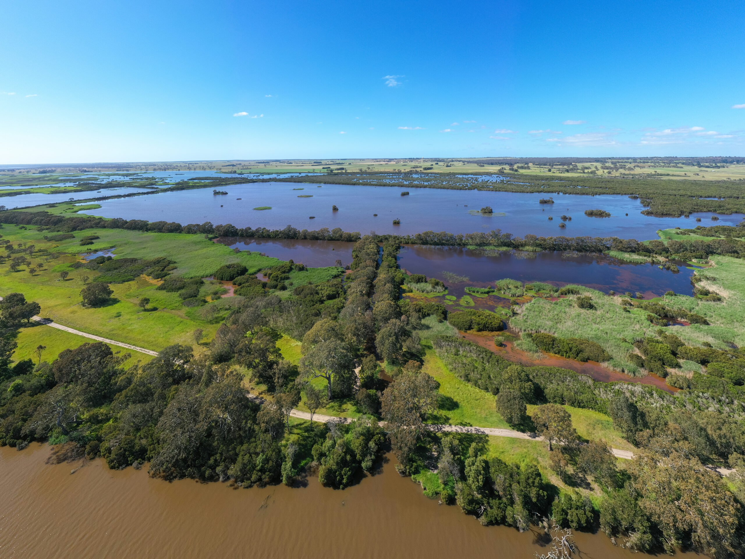
New watering infrastructure at Heart Morass on Gunaikurnai Country is playing its part in protecting the Gippsland Lakes’ precious fringing wetlands.

Water is the life source of Gippsland’s landscapes, ecosystems, communities and economy. Nowhere is this more evident than in the Latrobe River (Durt’Yowan) system where it provides water for towns, agriculture, industry, supports recreation and tourism, while supporting ecosystem and cultural values that sustain regional wellbeing.
As the Latrobe Valley transitions to a renewable energy future, the closure and rehabilitation of three large brown coal mines are not only reshaping the region’s economy but also how water moves through the landscape, how rivers function, and how communities, industries and ecosystems are sustained.
The transition presents significant risks but also a once-in-a-generation opportunity to transform the Latrobe from a working river into a river that works again. An opportunity to address legacy impacts, restore river processes, recover water for the environment and improve the health of the Latrobe River system.
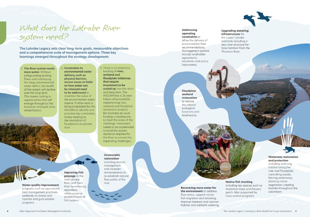
The Latrobe Legacy: Investing in river health for future generations (PDF 5MB) outlines the actions needed to build a resilient river system for future generations. Developed by the West Gippsland CMA and an independent panel of leading experts in river health.
Ultimately, this strategy is about the legacy we leave for future generations. It is about ensuring that the benefits of the energy transition extend beyond the rehabilitation of mine sites to the restoration and long-term health of the waterways, wetlands and communities that define Gippsland.
Now released publicly Durt’Yowan (Latrobe River): The Life Source short film, is available for you to watch and learn why the Latrobe River (Durt’Yowan) has been the life source for people in Gippsland for thousands of years.
With some big changes on the horizon for the Latrobe River or Durt’Yowan as the Gunaikurnai people have called it for thousands of years, it is important to know the story behind one of Gippsland’s longest rivers.
A: Durt’Yowan is the Gunaikurnai name for the Latrobe River system, it comprises the Latrobe River, its tributaries and the Lower Latrobe Wetlands, an important part of the Ramsar-listed Gippsland Lakes site.
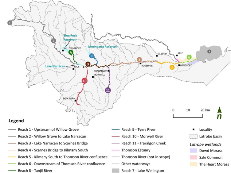
A: The Latrobe River (Durt’Yowan) supports plant and animal species of high conservation significance. The Latrobe River also provides an essential source of freshwater to the Ramsar listed Gippsland Lakes site, of which the Lower Latrobe Wetlands are an important component.
In addition to the environmental values, the Latrobe system supports cultural, social, recreational and economic values. Gunaikurnai people are the traditional owners of Gippsland, and the Latrobe system. Waterways and wetlands in the region contain important ceremonial places and for thousands of years the Latrobe River provided resources such as food and medicines to the Gunaikurnai people.
Fish species such as Australian Bass, Dwarf Galaxias, Australian Grayling and Estuary Perch call the river system their home along with platypus, rakali, frogs and burrowing crayfish.
Australian Bass were released into Traralgon creek a tributary of the Latrobe River, in December 2023 in partnership with Fisheries Victoria, this ‘King of the River’ video tells the story in full.
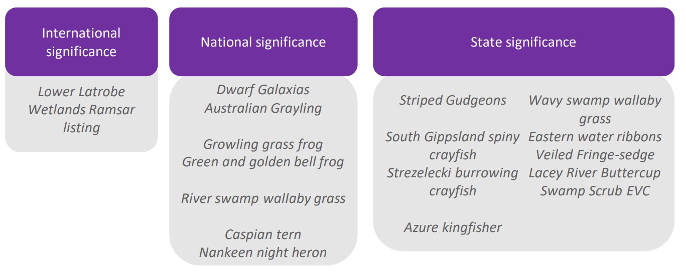
A: Environmental objectives guide the water requirement for the river system and represent the values that society seeks to improve or maintain with water for the environment.
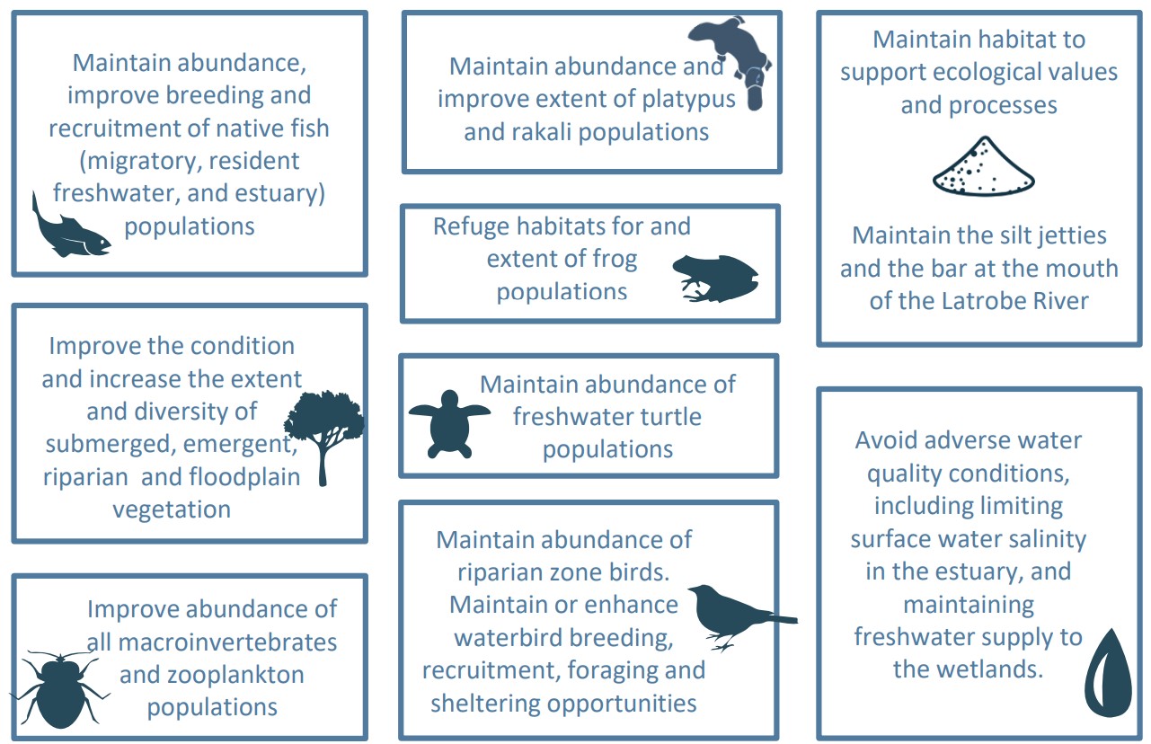
A: The current impacts to the environment and Traditional Owner values of the Latrobe River system (including its estuary and the Ramsar listed lower Latrobe wetlands) are due to historical river course modifications, river straightening, draining of swamps/wetlands, land clearing, removal of riparian vegetation, weeds, invasive animals, constructions of large on-stream storage’s and (critically) the large volume of water removed from the river for power generation, industry, urban supply, agriculture and other purposes.
Changes to the river course have induced significant erosion problems, reduced habitat for native species, created barriers to fish migration and altered flooding patterns. Changes to the flow regime of the river degrade it’s physical and ecological health, and therefore its ability to provide environmental, social economic and cultural benefits to the community. Although some water for the environment has been allocated to the Latrobe River system (in Blue Rock Reservoir), it is not sufficient to meet the communities objectives for the river and downstream environments.
A: Competing demands for water including water for mine rehabilitation, new and emerging industries, urban growth and agricultural expansion will all place pressures on the Latrobe’s precious water resources. This is likely to be overlaid by a trend toward a climate typified by drier conditions interspersed with intense weather events. Reduced freshwater flows in the river is the greatest threat to riverine health.
Additional risks associated with mine rehabilitation, and the potential formation of large pit lakes are being investigated through processes such as the Latrobe Valley Regional Rehabilitation Strategy and the Hazelwood Mine Rehabilitation Environment Effects Study.
A: Repurposing water for mine rehabilitation would impact the ability to meet the water needs of the river system (including the estuary and the lower Latrobe wetlands) and Traditional Owners. It would entrench the significant legacy impacts of coal fired power generation in the Latrobe Valley on the Latrobe River system. This would create an enduring opportunity cost to the Victorian community to heal Country and meet community expectations to improve the health of the Latrobe River system.
There are also impacts to the river’s health associated with the infrastructure built to harvest and supply river water for power generation (i.e. dams and other in-stream structures) including barriers to the movement of fish and sediment down the river.
A: The plants and animals that live in rivers rely on flows that naturally fluctuate over time according to patterns in climate and weather. This includes floods and low flows, and everything in between. Rivers need floods to remain healthy.
Floods are also vital for the health of salty environments, including estuaries and the ocean. The importance of moderate to large floods for Lake Wellington and its fringing wetlands cannot be overstated. Floods are responsible for flushing of salts through the system and providing important ecological cues for plants and animals. Plans to harvest floods to assist with rehabilitation of the Latrobe Valley coal mine voids should be carefully considered in this context.
A: The majority of towns and cities along the Latrobe River were settled at a time when floods were a regular occurrence. This meant that the towns and cities were built on higher ground to avoid most of the impacts of flooding.
Now, any development on or around the floodplain is required to go through a planning permit application process which considers the likelihood of floods impacts to the site as well as the implications of the development of neighbouring and downstream properties. Through this process, specific design elements are put on the development (eg. minimum ground floor level heights for a building) to reduce or remove the impacts of floods.
It is unlikely that ‘trimming’ floods will provide any meaningful mitigation benefit for downstream communities or landholders.
A: The West Gippsland CMA are passionate about river health. The CMA has a 25-year legacy of working with the community to improve the health of our waterways and wetlands. The CMA will be continuing in its efforts to help landholders and the community protect and revegetate riparian habitat, reinstatement natural river flow paths, remove barriers to fish passage, implement weed control and importantly secure more water for the environment.
We also recognise that the transition process in the Latrobe Valley provides a once-in-a-lifetime opportunity to accelerate these river health initiatives and build resilience into the river system to give it the best chance of surviving future challenges. The West Gippsland CMA has developed a strategy to turn this ‘working river’ into a river that works again. The Latrobe Legacy (PDF 5MB) comprises a package of management actions to improve the condition and health of the River system.
A: We encourage all community members to be curious, ask questions and get involved in the important discussions about the future of the Latrobe Valley and the river system.
If you wish to be informed of future opportunities via the CMA please sign up using this form.
To stay up to date with news and events relating to the Latrobe River (Durt’Yowan) submit the form below and we will keep in touch via email.
The following publications are all available for download.
New watering infrastructure at Heart Morass on Gunaikurnai Country is playing its part in protecting the Gippsland Lakes’ precious fringing wetlands.

Our latest Gippslandscapes podcast ‘Restoring the beating heart of wetlands’ is now out for your enjoyment.
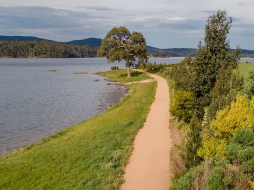
Visitors to Blue Rock Lake will benefit from erosion works that will protect the track ensuring continued access and supporting the lake’s health.
Rivers begin their journey in the headwaters, the remote Victorian Alps are home to some of the most pristine waterways in Victoria – and we’re working to keep them that way by removing invasive willows that clog waterways, damage riparian vegetation and spread downstream.
Removing willows helps to:
The project focuses on the upper reaches and tributaries of the Carran Carran (Thomson River), Wirn wirndook Yeerung (Macalister River) Avon and Durt’Yowan (Latrobe River) all in the Victorian Alps and the Tarwin (West Branch), Franklin, Agnes, Jack and Albert and Tarra rivers in the Strzelecki Ranges.
Willows spread easily by seed, branches and twigs, so part of the project is about identifying seed sources that are causing infestations downstream.
The Protecting Pristine Headwaters project is supported by the Victorian Government.
We are also working with landholders and neighbouring CMAs to coordinate willow control activities and share information.


Protecting West Gippsland’s rivers starts in their pristine headwaters where delicate ferns shimmer in the dappled light dancing through giant gums and Victoria’s rainforest ecosystems continue to thrive.
Corner Inlet Ramsar wetland is a recognised haven for migratory and resident shorebirds and made up of extensive seagrass meadows, and unique intertidal mudflats and forests of white mangrove (Avicennia marina) – the world’s most southerly distribution of this species.
This project aims to reduce key threats and protect and enhance the values of Corner Inlet wetland that is protected under the Convention of Wetlands declared in Ramsar, Iran in 1971.
We will work with Traditional Owners, partners, landholders and community to:
In the first of this five-year project, positive results were achieved including treating Spartina, controlling foxes to protect shorebirds, improving water quality, and safeguarding 136 hectares of saltmarsh including a 25 hectare Trust for Nature covenant protecting the area forever.
In total, weed control covered over the entire site of 67,000 hectares with 530 hectares of pest animal control and water monitoring will help measure results of the efforts across the broader catchment.
BirdLife Australia teams undertook seasonal shorebird counts and monitored the breeding success and health of key species of beach nesting birds such as Hooded Plovers, Pied Oystercatchers and Crested, Caspian and Fairy terns.
The $3 M project is funded by the Australian Government Natural Heritage Trust and delivered by West Gippsland CMA, a member of the Commonwealth Regional Delivery Partners panel.
We have prepared a new video about the incredible 30-year journey to eradicate Spartina from Corner Inlet.

In a special corner of South Gippsland in Victoria, Corner Inlet is hard at work playing its part to protect biodiversity and maintain healthy ecosystems with West Gippsland Catchment Management Authority (CMA) giving it a helping hand through the Corner Inlet Connections project.
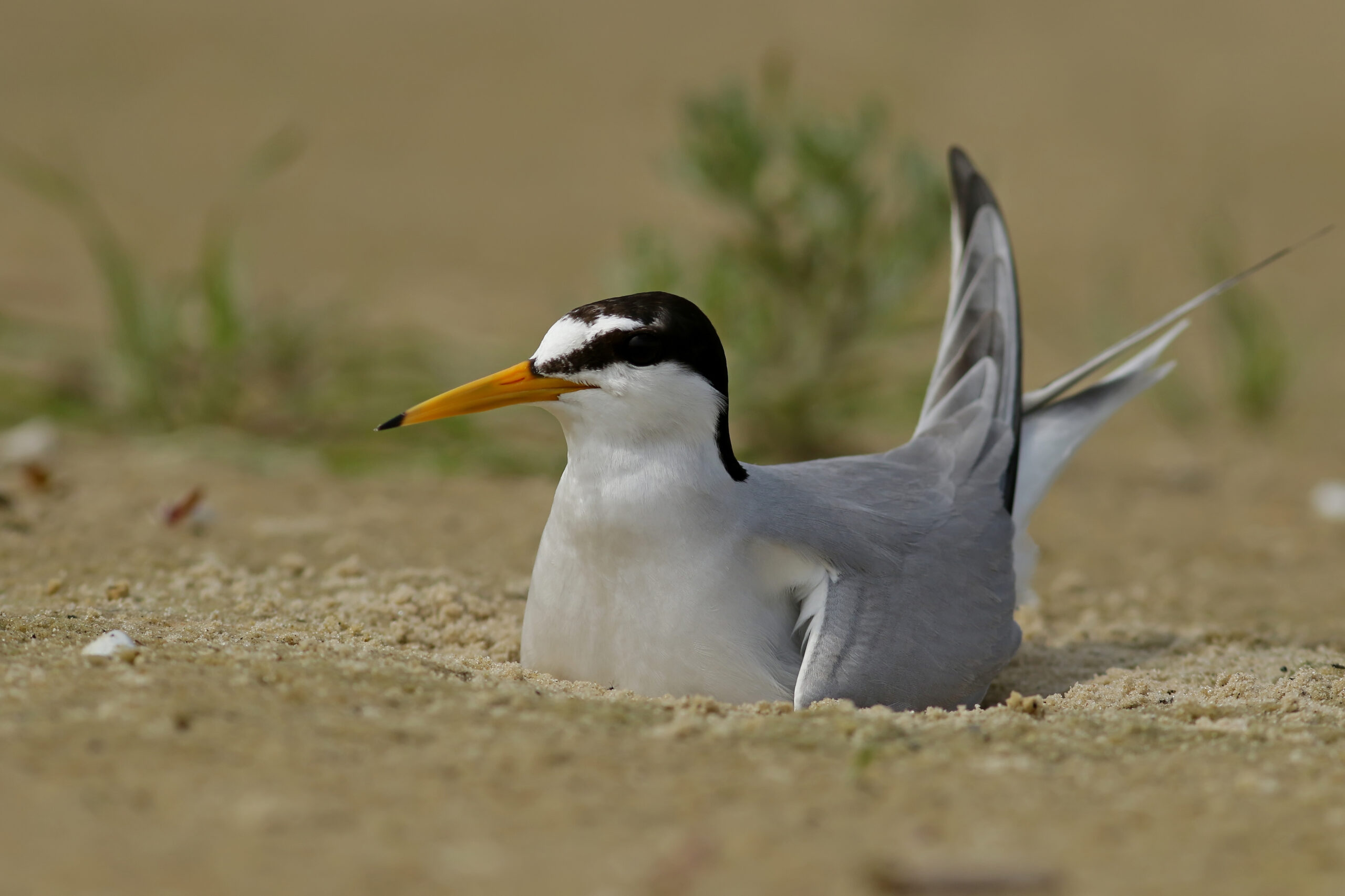
Capturing an elusive fox on Dream Island, tackling weed infestations and keeping watch over threatened beach nesting birds are just some events in the compelling story of the past year of West Gippsland CMA’s Corner Inlet Connections project.
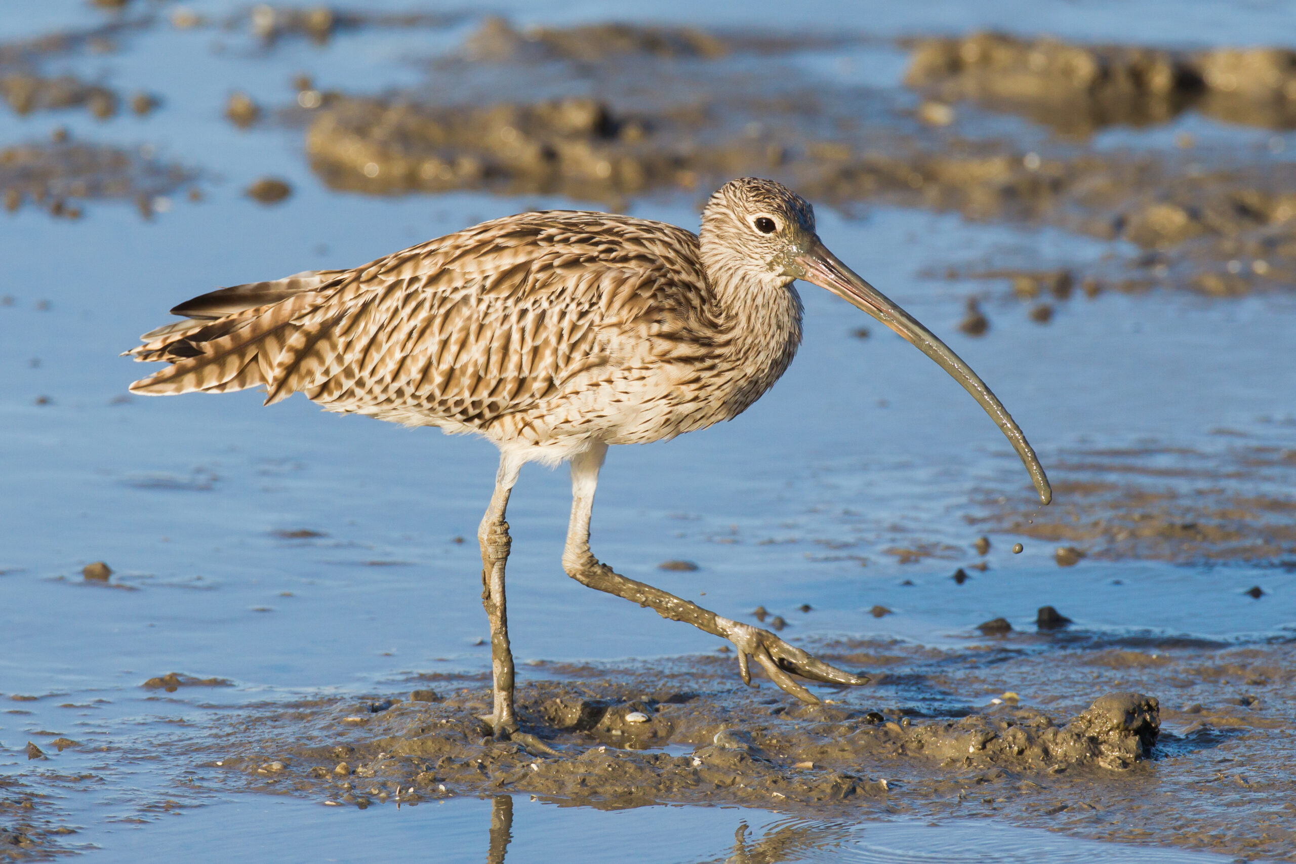
This World Wetlands Day, held on Sunday 2 February, West Gippsland Catchment Management Authority, (the CMA) is proud to celebrate the ongoing commitment to protecting world renowned Corner Inlet Ramsar wetland through its Corner Inlet Connections project.
Toward Zero Extinctions: Protecting the Eastern Hooded Plover is a four-year project aimed at saving this threatened species from extinction.
The project focuses on the the coastline between San Remo and Sandy Point in South Gippsland, that is home to the second largest population of Hoodies in Victoria.
It involves:
The $1.5M project is funded by the Australian Government Natural Heritage Trust and delivered by West Gippsland CMA, a member of the Commonwealth Regional Delivery Partners panel.

When it comes to helping save Hooded Plovers from extinction numbers count and West Gippsland Catchment Management Authority (CMA) is thrilled to report that figures from the 2025-26 breeding season in South Gippsland are positive.

Closing soon – Dairy farmers in South Gippsland’s Powlett River catchment are set to make the most of manure thanks to new funding available from 1 April 2026.

The room was full of plover lovers recently as West Gippsland Catchment Management Authority (CMA) and partners gathered at Kilcunda on Bunurong Country to talk progress on plover protection as part of their Toward Zero Extinctions: Protect the Eastern Hooded Plover project.
This second stage of the Kugerungmome project builds on the previous four-year program which established strong partnerships and collaborative delivery of on ground outcomes.
The current project will deliver environmental improvement outcomes on the ground and continue to build even stronger partnerships to work together in, and advocate for, the catchment and river to deliver on our shared vision.
The on-ground projects will bring landholders and community together and expand the reach and possibilities of works to build a sense of stewardship to leave a lasting legacy in the catchment covering over 50,000 hectares.
The Kugerungmome/Powlett River Partnership project is supported by the Victorian Government through the Our Catchment Our Communities Program.

When it comes to helping save Hooded Plovers from extinction numbers count and West Gippsland Catchment Management Authority (CMA) is thrilled to report that figures from the 2025-26 breeding season in South Gippsland are positive.

Closing soon – Dairy farmers in South Gippsland’s Powlett River catchment are set to make the most of manure thanks to new funding available from 1 April 2026.

The room was full of plover lovers recently as West Gippsland Catchment Management Authority (CMA) and partners gathered at Kilcunda on Bunurong Country to talk progress on plover protection as part of their Toward Zero Extinctions: Protect the Eastern Hooded Plover project.

Take a trip to the picturesque Kugerungmome/Powlett River on…
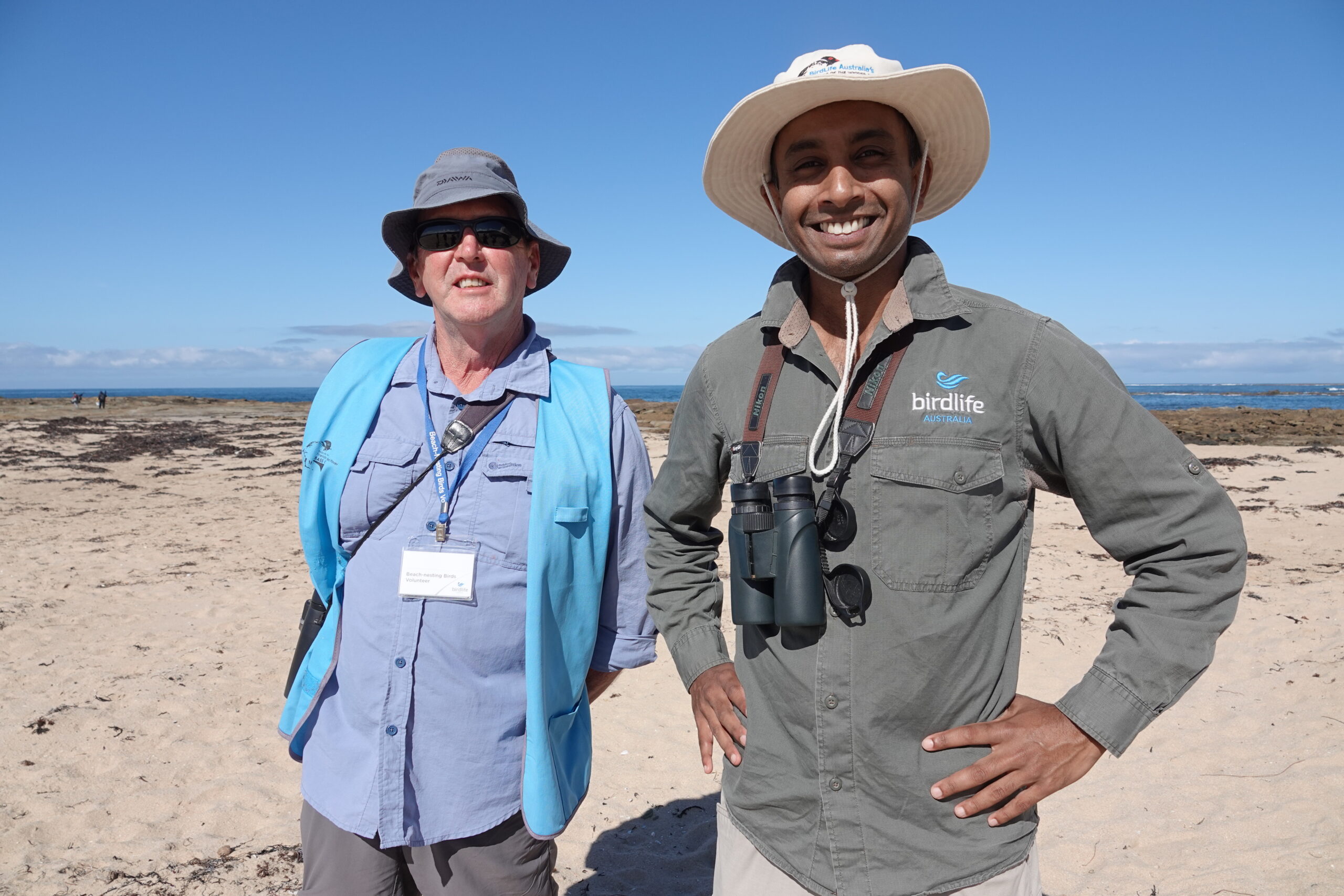
Every day over summer David Hartney goes for a walk along the beach at Cape Paterson. He takes his time, observing the changes in the dunes, the telltale tracks of wildlife, the rise and swell of the tide.

In this episode of Gippslandscapes we chat with Hooded Plover guru Kasun Ekanayake from BirdLife Australia about the plight of the plover and how devoted volunteers like David Hartney are helping to save them from extinction.

16 Hotham Street Traralgon
Victoria 3844 Australia
1300 094 262
(03) 5175 7800
Office hours:
8:30am - 3pm
Monday - Friday

We acknowledge and pay our respects to the Traditional Owners of the region, the Gunaikurnai, the Bunurong, the Boonwurrung and the Wurundjeri peoples, their rich culture and spiritual connection to Country.
We also acknowledge the responsibility to care for Country of Aboriginal and/or Torres Strait Islander Peoples and organisations in Natural Resource Management and pay respects to Elders, past, present and emerging.


